Area Overview for B90 3RE
Photos of B90 3RE


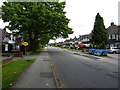
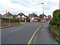
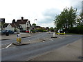
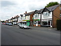

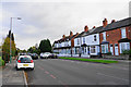


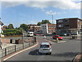
28 photos from this area
Area Information
Key information about the B90 3RE including its size, population, and administrative classification.
- Area Type
- Postcode
- Area Size
- 1.7 hectares
- Population
- 1448
- Population Density
- 5175 people/km²
House Prices in B90 3RE
32
Properties
£285,443
Average Sold Price
£87,000
Lowest Price
£512,000
Highest Price
Showing 32 properties
| Address | Type | Beds | Baths | Last Sale Price | Last Sale Date | |
|---|---|---|---|---|---|---|
| 60 Moorlands Drive, Shirley, Solihull, B90 3RE | Retail | 3 | 1 | £410,000 | Oct 2022 | |
| 80 Moorlands Drive, Shirley, Solihull, B90 3RE | house | - | - | £355,000 | Aug 2022 | |
| 82 Moorlands Drive, Shirley, Solihull, B90 3RE | house | - | - | £512,000 | Aug 2022 | |
| 100 Moorlands Drive, Shirley, Solihull, B90 3RE | Bungalow | 3 | 1 | £347,000 | Sep 2021 | |
| 110 Moorlands Drive, Shirley, Solihull, B90 3RE | Bungalow | 2 | - | £436,000 | Jun 2021 | |
| 98 Moorlands Drive, Shirley, Solihull, B90 3RE | Bungalow | 2 | 1 | £350,000 | May 2021 | |
| 102 Moorlands Drive, Shirley, Solihull, B90 3RE | Bungalow | 2 | 1 | £315,000 | Sep 2019 | |
| 106 Moorlands Drive, Shirley, Solihull, B90 3RE | Bungalow | 2 | 1 | £250,000 | Mar 2019 | |
| 84 Moorlands Drive, Shirley, Solihull, B90 3RE | Detached | 4 | 2 | £371,000 | Dec 2015 | |
| 116 Moorlands Drive, Shirley, Solihull, B90 3RE | Bungalow | 2 | - | £255,000 | Nov 2015 |
Page 1 of 4
Energy Efficiency in B90 3RE
Amenities
Schools
| Rank | School | Type | Entry gender | Ages |
|---|
Explore more schools in this area
Go to Schools tabDemographics
Household Size
One person
most common
Accommodation Type
Houses
most common
Tenure
67
majority
Ethnic Group
White
most common
Religion
N/A
most common
Household Composition
N/A
most common
Age
47
median
Adults (30-64 years)
most common
Household Deprivation
N/A
with no deprivation
NS-SEC
35
in Lower managerial occupations
Explore more demographic insights in this area
Go to Demographics tabPlanning
Planning Constraints
- Flood RiskPremium
- Ramsar Wetland SitesPremium
- Area of Outstanding Natural BeautyPremium
- Protected Nature ReservePremium
- Protected WoodlandPremium