Area Overview for B90 3EN
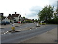
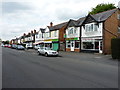
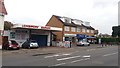
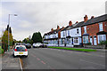
Photos of B90 3EN


Area Information
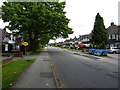
The postcode B90 3EN sits within the Shirley East Ward of the Metropolitan Borough of Solihull in the West Midlands. It is a specific residential cluster covering an area of 4,468 square metres with a population of 1,746. This neighbourhood forms part of the wider suburb of Shirley, a settlement that historically grew along the Stratford Road after the Manors of Ulverlei and Shirley merged under Solihull parish. The location is centred around coordinates 52.410039665340506, -1.8252348333201867, anchoring it firmly within the suburban fabric of the region. Living in B90 3EN means residing in a small, defined community that retains historical roots dating back to the Late Middle Ages. While the area has evolved from a small settlement known as Shirley Street, it now functions as a quiet residential zone. You are stepping away from the main thoroughfares but remain close to key transport links like Shirley Railway Station, which opened in 1908. Daily life here is shaped by a high density of residents within a compact footprint, offering a sense of locality without the sprawl of larger suburban districts. The history of the area includes significant milestones, such as the establishment of St James Church and the development via the Great Western Railway line.
- Area Type
- Postcode
- Area Size
- 4468 m²
- Population
- 1746
- Population Density
- 3520 people/km²
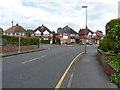
Homes in B90 3EN are defined by a stark statistic: 75% home ownership. This figure indicates that the vast majority of properties are owned-occupied rather than rental stock. The accommodation type is almost exclusively houses, which aligns with the suburban history of Shirley and the preference of the adult male-dominated workforce in mid-life. When looking at the market in this small postcode, you are dealing with a low turnover of tenanted properties. This high ratio of owners suggests a mature housing stock where sellers are often motivated by relocation rather than immediate entry by new landlords. The area does not feature a significant concentration of multi-unit blocks or flats, distinguishing it from more urban edge locations. For a buyer entering the market, this means fewer competition from investor landlords should be a factor. Instead, you compete with other families or individuals looking to swap larger properties or downsize within the Solihull borough. The lack of rental pressure often stabilises prices and reduces speculative short-term flips. Understanding this landscape is vital when pricing a home or attempting a sale in a cluster where organic community tenure is the norm.
House Prices in B90 3EN
Showing 10 properties
| Address | Type | Beds | Baths | Last Sale Price | Last Sale Date | |
|---|---|---|---|---|---|---|
| 207 Longmore Road, Shirley, Solihull, B90 3EN | house | - | - | £357,500 | Apr 2021 | |
| 201 Longmore Road, Shirley, Solihull, B90 3EN | Semi-detached | 3 | 1 | £235,000 | Jan 2019 | |
| 199 Longmore Road, Shirley, Solihull, B90 3EN | Semi-detached | 4 | 2 | £340,000 | May 2018 | |
| 189 Longmore Road, Shirley, Solihull, B90 3EN | Semi-detached | 5 | 2 | £238,000 | Aug 2014 | |
| 191 Longmore Road, Shirley, Solihull, B90 3EN | Semi-detached | - | - | £168,000 | Dec 2009 | |
| 197 Longmore Road, Shirley, Solihull, B90 3EN | Semi-detached | - | - | £240,000 | Aug 2006 | |
| 205 Longmore Road, Shirley, Solihull, B90 3EN | Semi-detached | 3 | 1 | £67,000 | Jul 1997 | |
| 193 Longmore Road, Shirley, Solihull, B90 3EN | Semi-detached | - | - | - | - | |
| 195 Longmore Road, Shirley, Solihull, B90 3EN | Semi-detached | - | - | - | - | |
| 203 Longmore Road, Shirley, Solihull, B90 3EN | Semi-detached | - | - | - | - |
Energy Efficiency in B90 3EN
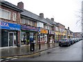
Your daily life in B90 3EN supports convenience without forcing you into long commutes for essentials. Within practical reach, you have five retail options including Co-op Shirley, Lidl Sears, and M&S Sears. These retailers cover groceries and household needs from a centralised shopping point. Five railway stations are also listed nearby, giving you flexibility for travel. Specifically, Solihull Railway Station, Shirley Railway Station, and Widney Manor Railway Station offer rail access for daily commutes. For longer journeys, Birmingham International Airport and Birmingham Intl Railway Station provide broader national and international connectivity. This mix of retail and rail options means you can manage errands and travel needs efficiently. The historical context of the area adds character, with landmarks like St James Church and the Berry Mound Iron Age Hill Fort visible from the North Worcestershire Path offering local interest for those interested in history. While the specific plot size of 4,468 square metres is small, the surrounding amenities ensure you have everything required for a functional household nearby.
Amenities
Schools
Families considering B90 3EN have access to Shirley Heath Junior School, which is located within practical reach of the residential cluster. This educational provision is a primary school rated outstanding by inspectors. The presence of an outstanding rated primary school next to a home in B90 3EN is a significant practical asset for parents moving into the area. As the school data provided only lists this primary institution, there are no secondary schools explicitly documented within the immediate vicinity of this specific postcode in the available information. This usually implies that families settle here with the intention of commuting to secondary education in the wider Solihull catchment area or transferring children as they progress. The outstanding rating indicates high standards in curriculum and child safety, aligning with the needs of a community where the median age is 47. You gain immediate access to early education that meets the highest regulatory standards without needing to travel far to find a suitable place for your youngest child.
| Rank | School | Type | Entry gender | Ages |
|---|
Explore more schools in this area
Go to Schools tabDemographics
The community in B90 3EN is characterised by an older, stable population where 75% of residents own their homes. The demographic profile clearly shows that the most common age range is adults between 30 and 64 years, with a median age of 47. This skew towards middle-aged adults suggests a settlement where families have settled long-term rather than chasing transient trends. Accommodation consists primarily of houses, reinforcing the image of established residential living rather than high-density flats or terraced blocks. The predominant ethnic group in this specific cluster is White, reflecting the historical demographic patterns of Solihull and Shirley. With a high home ownership rate, the area likely attracts those seeking stability and autonomy over their living space. The population density, while calculated as 390,797 people per square kilometre for the tiny postcode footprint, indicates significant employment in the house itself or a very concentrated cluster of dwellings. This age profile and ownership structure mean the neighbourhood is best suited for buyers looking for a permanent base rather than a temporary city-edge rental. Families with school-age children will find an environment where neighbours are likely in a similar life stage.
Household Size
Accommodation Type
Tenure
Ethnic Group
Religion
Household Composition
Age
Household Deprivation
NS-SEC
Explore more demographic insights in this area
Go to Demographics tabPlanning
Planning Constraints
- Flood RiskPremium
- Ramsar Wetland SitesPremium
- Area of Outstanding Natural BeautyPremium
- Protected Nature ReservePremium
- Protected WoodlandPremium