Area Overview for B90 3DY
Photos of B90 3DY
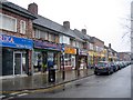
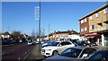
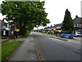
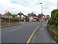

28 photos from this area
Area Information
Key information about the B90 3DY including its size, population, and administrative classification.
- Area Type
- Postcode
- Area Size
- 1.8 hectares
- Population
- 1740
- Population Density
- 4778 people/km²
House Prices in B90 3DY
37
Properties
£258,587
Average Sold Price
£81,000
Lowest Price
£463,000
Highest Price
Showing 37 properties
| Address | Type | Beds | Baths | Last Sale Price | Last Sale Date | |
|---|---|---|---|---|---|---|
| 54 Longmore Road, Shirley, Solihull, B90 3DY | Semi-detached | 4 | 2 | £463,000 | Aug 2025 | |
| 36 Longmore Road, Shirley, Solihull, B90 3DY | house | - | - | £402,500 | Dec 2024 | |
| 14 Longmore Road, Shirley, Solihull, B90 3DY | Terraced | 3 | 1 | £325,000 | Sep 2024 | |
| 38 Longmore Road, Shirley, Solihull, B90 3DY | house | - | - | £410,000 | Sep 2021 | |
| 58 Longmore Road, Shirley, Solihull, B90 3DY | house | - | - | £310,000 | Mar 2021 | |
| 6 Longmore Road, Shirley, Solihull, B90 3DY | Terraced | 3 | 1 | £279,950 | Dec 2020 | |
| 18 Longmore Road, Shirley, Solihull, B90 3DY | Detached | 3 | 1 | £454,000 | Apr 2018 | |
| 20 Longmore Road, Shirley, Solihull, B90 3DY | Detached | 3 | 1 | £405,000 | Mar 2018 | |
| 16 Longmore Road, Shirley, Solihull, B90 3DY | Terraced | 3 | 1 | £240,000 | Jun 2017 | |
| 60 Longmore Road, Shirley, Solihull, B90 3DY | house | - | - | £338,000 | Mar 2017 |
Page 1 of 4
Energy Efficiency in B90 3DY
Amenities
Schools
| Rank | School | Type | Entry gender | Ages |
|---|
Explore more schools in this area
Go to Schools tabDemographics
Household Size
Family (3-5 people)
most common
Accommodation Type
Houses
most common
Tenure
87
majority
Ethnic Group
White
most common
Religion
N/A
most common
Household Composition
N/A
most common
Age
47
median
Adults (30-64 years)
most common
Household Deprivation
N/A
with no deprivation
NS-SEC
42
in Lower managerial occupations
Explore more demographic insights in this area
Go to Demographics tabPlanning
Planning Constraints
- Flood RiskPremium
- Ramsar Wetland SitesPremium
- Area of Outstanding Natural BeautyPremium
- Protected Nature ReservePremium
- Protected WoodlandPremium