Area Overview for B90 3DT
Photos of B90 3DT
Area Information
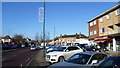
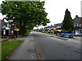
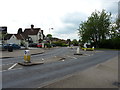
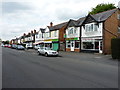
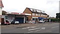
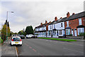
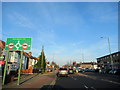
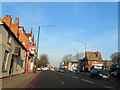
B90 3DT is a compact residential postcode in the western part of Solihull, West Midlands, England. Covering just 1,905 square metres, it is densely populated, with 1,448 residents squeezed into a small cluster. This area, part of the Shirley South electoral ward, sits within a historically rural settlement that evolved into a suburban hub. Its proximity to Stratford Road, a key arterial route, connects it to broader Solihull and Birmingham. Daily life here blends urban convenience with suburban tranquillity, with a mix of commercial and residential activity. The area’s character is defined by its historic roots, including Shirley Street, once a turnpike road, and modern amenities like retail parks and transport links. Residents benefit from nearby rail stations, including Shirley and Solihull, and proximity to Birmingham International Airport. The high population density suggests a tight-knit community, though the small size means the area is best suited for those prioritising convenience over expansive living space.
- Area Type
- Postcode
- Area Size
- 1905 m²
- Population
- 1448
- Population Density
- 5175 people/km²
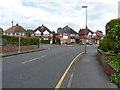
B90 3DT is primarily an owner-occupied area, with 67% of homes owned by residents rather than rented. The accommodation type is predominantly houses, which is unusual for a small postcode but reflects the suburban character of the area. This suggests a focus on family homes and larger properties, potentially limiting availability for renters or those seeking smaller units. Given the high population density and small area size, the housing stock is likely limited, and buyers should consider nearby suburbs for more options. The prevalence of houses may also indicate a quieter, more private living environment compared to high-density urban areas.
House Prices in B90 3DT
No properties found in this postcode.
Energy Efficiency in B90 3DT
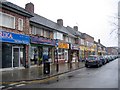
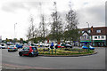
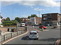
Residents of B90 3DT have access to a range of amenities within practical reach. Retail options include M&S Stratford Rd Solihull BP, Sainsburys Marshall, and Lidl Sears, catering to daily needs. The area’s proximity to Shirley Golf Club and Marshall Lake Park offers leisure opportunities, while historic sites like St James’ Church and the former Odeon Cinema add cultural value. Educational facilities include Sharmans Cross Senior School, which opened in 1934. The mix of retail, green spaces, and historical landmarks contributes to a balanced lifestyle, blending convenience with suburban charm. However, the small area size means residents may need to travel slightly further for more specialised services.
Amenities
Schools
| Rank | School | Type | Entry gender | Ages |
|---|
Explore more schools in this area
Go to Schools tabDemographics
The population of B90 3DT is 1,448, with a median age of 47 and the majority of residents aged 30–64. This suggests a mature community, likely comprising families and professionals. Home ownership is high at 67%, indicating a stable, long-term resident base. The area is predominantly composed of houses, reflecting a preference for single-family dwellings over flats. The predominant ethnic group is White, aligning with broader Solihull demographics. The absence of specific data on deprivation means it is unclear how economic challenges might affect quality of life, but the high home ownership rate and age profile suggest a relatively affluent, settled population.
Household Size
Accommodation Type
Tenure
Ethnic Group
Religion
Household Composition
Age
Household Deprivation
NS-SEC
Explore more demographic insights in this area
Go to Demographics tabPlanning
Planning Constraints
- Flood RiskPremium
- Ramsar Wetland SitesPremium
- Area of Outstanding Natural BeautyPremium
- Protected Nature ReservePremium
- Protected WoodlandPremium