Area Overview for B90 3AW
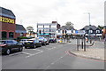
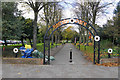
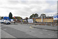
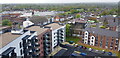
Photos of B90 3AW


Area Information
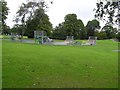
B90 3AW is a small residential postcode area in the heart of Shirley West, Solihull, England. With a population of 2,297, it forms part of a historically rooted suburb that evolved from a farming settlement. Situated approximately 3 miles southeast of Solihull town centre, the area lies along Stratford Road, a key arterial route linking to Birmingham and Stratford-upon-Avon. Its proximity to the M42 motorway ensures easy access to major cities, while nearby railway stations like Shirley and Yardley Wood provide direct links to Birmingham and beyond. The area’s character is defined by its mix of older housing stock and post-war developments, reflecting a community that has grown steadily over decades. With a median age of 47 and a strong presence of adults aged 30–64, B90 3AW is a stable, family-oriented area where homeownership is common. Its compact size means residents often live within walking distance of local amenities, creating a tight-knit, accessible environment.
- Area Type
- Postcode
- Area Size
- Not available
- Population
- 2297
- Population Density
- 4743 people/km²
The property market in B90 3AW is characterised by a high rate of home ownership (78%) and a predominance of houses over flats. This suggests a mature, owner-occupied market with limited rental activity, typical of suburban areas with established housing stock. The compact nature of the postcode area means property options are relatively limited, though the immediate surroundings—such as nearby Shirley and Yardley Wood—may offer more variety. The focus on houses rather than flats indicates a preference for private, family-oriented living spaces. For buyers, this translates to a market where properties are likely to be long-term investments, with fewer opportunities for short-term rental or speculative purchases. The area’s proximity to transport links and amenities also makes it attractive for those seeking a balance between suburban tranquillity and urban connectivity.
House Prices in B90 3AW
No properties found in this postcode.
Energy Efficiency in B90 3AW
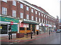
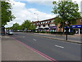
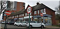
Residents of B90 3AW have access to a range of nearby amenities, including five retail outlets such as Aldi Shirley, Iceland Shirley, and Asda Shirley, ensuring everyday shopping needs are met within easy reach. The area’s transport links—five railway stations and connections to Birmingham International Airport—provide convenience for both commuting and travel. While the data does not list specific parks or leisure facilities, the proximity to Stratford Road and the M42 motorway suggests opportunities for outdoor activities in nearby green spaces. The urban character of the area, combined with practical retail and transport options, creates a lifestyle that balances suburban comfort with urban accessibility.
Amenities
Schools
The nearest school to B90 3AW is Haslucks Green School, a primary school with an Ofsted rating of ‘good’. This provides families with a locally accessible option for early education, though secondary schooling would require travel to nearby towns. The presence of a primary school with a positive rating supports the area’s appeal to families, ensuring children have a reliable starting point for their education. The absence of secondary schools in the immediate vicinity means parents may need to consider commuting to larger towns like Solihull or Birmingham. However, the quality of the primary school helps offset this limitation, offering a foundation for academic development within the community.
| Rank | School | Type | Entry gender | Ages |
|---|
Explore more schools in this area
Go to Schools tabDemographics
The population of B90 3AW is predominantly composed of adults aged 30–64, with a median age of 47. This suggests a mature community with a strong presence of middle-aged and older residents. Homeownership is high, with 78% of properties owner-occupied, indicating a settled demographic less reliant on rental housing. The area is primarily composed of houses rather than flats, aligning with the typical housing stock of suburban areas. The predominant ethnic group is White, reflecting the broader demographic trends of the Solihull borough. While specific data on deprivation is not provided, the area’s home ownership rate and age profile suggest a relatively stable quality of life, though comparisons to adjacent wards like Shirley East—where deprivation is more pronounced—highlight that B90 3AW is less economically challenged. This stability supports a community focused on long-term residency and family living.
Household Size
Accommodation Type
Tenure
Ethnic Group
Religion
Household Composition
Age
Household Deprivation
NS-SEC
Explore more demographic insights in this area
Go to Demographics tabPlanning
Planning Constraints
- Flood RiskPremium
- Ramsar Wetland SitesPremium
- Area of Outstanding Natural BeautyPremium
- Protected Nature ReservePremium
- Protected WoodlandPremium