Area Overview for B90 3AN
Photos of B90 3AN


Area Information
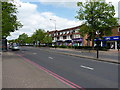
Living in B90 3AN means inhabiting a small, tightly knit residential cluster in the Shirley area of Solihull, West Midlands. With a population of 2,297, this postcode reflects a modest, established community situated approximately 3 miles southeast of Solihull town centre. Historically rooted in farming, Shirley has evolved into a suburban area with a mix of older and mid-20th-century housing. Its location along the Stratford Road, near the M42 motorway, offers easy access to Birmingham and Stratford-upon-Avon. The area’s character is defined by its proximity to local amenities, including retail outlets, rail stations, and the nearby Birmingham International Airport. While not a high-income suburb, B90 3AN avoids the extremes of deprivation seen in parts of Shirley East, offering a balanced, community-focused environment. For buyers, this area provides a quiet alternative to busier urban centres, with a focus on family-friendly living and practical connectivity.
- Area Type
- Postcode
- Area Size
- Not available
- Population
- 2297
- Population Density
- 4743 people/km²
The property market in B90 3AN is dominated by owner-occupied homes, with 78% of residents living in properties they own. The accommodation type is primarily houses, which is typical of suburban areas with lower population density. This suggests a market where larger, more established homes are the norm, rather than flats or apartments. The high home ownership rate indicates a community of long-term residents, which can contribute to a sense of stability and continuity. For buyers, this small area offers a limited but distinct housing stock, with properties likely to be older or mid-20th-century in construction. The focus on houses rather than rental properties means the market is less dynamic, with fewer opportunities for short-term investment. Prospective buyers should consider the area’s proximity to transport links and local amenities when evaluating property value and long-term suitability.
House Prices in B90 3AN
No properties found in this postcode.
Energy Efficiency in B90 3AN
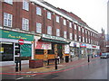
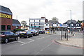
Residents of B90 3AN have access to a range of nearby amenities, including five retail outlets such as Aldi Shirley, Iceland Shirley, and Asda Shirley. These shops provide convenience for daily needs, though the area lacks specific details on dining or leisure venues. The proximity to rail stations like Shirley and Yardley Wood, along with metro connections to Birmingham International Airport, enhances mobility for both shopping and travel. The area’s suburban character means it balances practicality with a quieter lifestyle, avoiding the congestion of larger cities. While no parks or recreational facilities are explicitly listed, the historical context of Shirley suggests potential green spaces in nearby areas. Overall, the amenities support a functional, community-oriented lifestyle with a focus on accessibility and connectivity.
Amenities
Schools
The nearest school to B90 3AN is Haslucks Green School, a primary school with an Ofsted rating of “good.” This provides families with a reliable option for early education, though no secondary schools are listed in the data. The presence of a well-rated primary school is a key consideration for families prioritising education quality. However, the absence of secondary school data means parents may need to look further afield for secondary education. The single school listed suggests a modest educational infrastructure, which could be a limitation for families requiring comprehensive schooling within the immediate area. Nonetheless, the “good” rating at Haslucks Green School indicates a baseline level of academic and pastoral support for younger children.
| Rank | School | Type | Entry gender | Ages |
|---|
Explore more schools in this area
Go to Schools tabDemographics
The population of B90 3AN has a median age of 47, with the most common age group being adults aged 30–64. This suggests a mature, stable community with a strong presence of middle-aged households. Home ownership is high at 78%, indicating a preference for long-term residency over rental properties. The predominant accommodation type is houses, which aligns with the area’s suburban character. The predominant ethnic group is White, reflecting the broader demographic patterns of the West Midlands. While no specific data on deprivation levels is provided, the area is described as “less prosperous than some neighbouring areas” but without the “extremes of deprivation” found in Shirley East. This implies a generally moderate quality of life, with access to essential services but limited high-end amenities. The age profile suggests a community focused on stability, with fewer young families compared to areas with higher birth rates.
Household Size
Accommodation Type
Tenure
Ethnic Group
Religion
Household Composition
Age
Household Deprivation
NS-SEC
Explore more demographic insights in this area
Go to Demographics tabPlanning
Planning Constraints
- Flood RiskPremium
- Ramsar Wetland SitesPremium
- Area of Outstanding Natural BeautyPremium
- Protected Nature ReservePremium
- Protected WoodlandPremium