Area Overview for B90 2SU
Photos of B90 2SU


Area Information
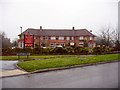
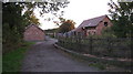
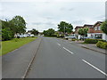
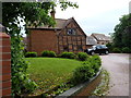
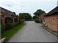
Living in B90 2SU means being part of a small, tightly knit residential cluster in the Shirley area of Solihull, West Midlands. With a population of 1,529, this postcode area sits within Shirley South, an electoral ward historically rooted in rural Warwickshire but now a well-established urban suburb. The area is bisected by Stratford Road, a historic route that once served as a turnpike, and is surrounded by a mix of residential and commercial activity. Daily life here balances proximity to retail, transport, and green spaces with a quiet, suburban rhythm. The area’s character is shaped by its post-WWII development, including housing estates and former industrial sites like the Lucas factory. Residents benefit from being near Solihull’s economic hubs, with office spaces, distribution centres, and retail parks nearby. B90 2SU is ideal for those seeking a stable, family-oriented environment with access to amenities without the congestion of larger cities. Its compact size means community ties are strong, and local landmarks like St James’ Church and Marshall Lake Park add to its distinct identity.
- Area Type
- Postcode
- Area Size
- Not available
- Population
- 1529
- Population Density
- 2905 people/km²
The property market in B90 2SU is overwhelmingly owner-occupied, with 94% of homes owned by residents rather than rented. This high rate of home ownership suggests a stable, long-term community with limited turnover. The accommodation type is predominantly houses, which is unusual for modern UK property markets, where flats and apartments are more common. This indicates a focus on larger, family-oriented homes, likely with gardens and private outdoor space. The area’s small size means the housing stock is limited, and buyers should consider proximity to surrounding districts for more options. The lack of rental properties may make it challenging for those seeking short-term accommodation, but for long-term buyers, the market offers security and a sense of permanence. The predominance of houses also implies a quieter, more private lifestyle compared to high-density developments.
House Prices in B90 2SU
No properties found in this postcode.
Energy Efficiency in B90 2SU
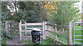
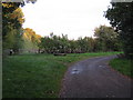
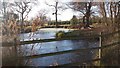
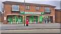
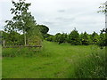
Residents of B90 2SU have access to a range of amenities within practical reach. Retail options include Sainsburys Solihull Haslucks, M&S Stratford Rd Solihull BP, and Sainsburys Marshall, offering everyday shopping needs. The area also features leisure spaces such as Marshall Lake Park, which provides greenery and recreational opportunities. Nearby, historic sites like St James’ Church and the former Odeon Cinema add cultural depth. The presence of multiple railway stations and proximity to Birmingham International Airport enhance convenience for travel and commuting. The mix of retail, green spaces, and transport links creates a balanced lifestyle, blending suburban tranquillity with urban accessibility. This variety ensures residents can enjoy both local amenities and broader regional opportunities without significant effort.
Amenities
Schools
Residents of B90 2SU have access to two notable schools. Light Hall School Specialist Mathematics and Computing College is a primary school, offering early education with a focus on STEM subjects. Nearby is Light Hall School, an academy with an Ofsted rating of “good.” This mix of a specialist primary school and a well-rated academy provides families with a range of educational options, from early years to secondary education. The presence of an academy suggests a commitment to academic standards, while the specialist college caters to younger students with a focus on mathematics and computing. These schools are likely to attract families prioritising educational quality and diversity in learning environments. The proximity of both institutions within the area reduces the need for long commutes, enhancing convenience for parents and students alike.
| Rank | School | Type | Entry gender | Ages |
|---|---|---|---|---|
| 1 | Light Hall School Specialist Mathematics and Computing College | primary | N/A | N/A |
| 2 | Light Hall School | academy | N/A | N/A |
Explore more schools in this area
Go to Schools tabDemographics
The community in B90 2SU is predominantly composed of adults aged 30–64, with a median age of 47. This suggests a mature, established population, likely with long-term ties to the area. Home ownership is exceptionally high at 94%, indicating a stable, owner-occupied market with few rental properties. The majority of accommodation is in houses, reflecting a preference for larger, family-friendly homes. The predominant ethnic group is White, though no specific data on diversity or deprivation is provided. The age profile and home ownership rates suggest a community focused on long-term residency, with fewer transient populations. This demographic profile aligns with the area’s suburban character, where families and professionals coexist in a low-density, low-traffic environment. The lack of younger residents or students may mean fewer amenities tailored to those groups, but the existing infrastructure caters to a settled, middle-aged population.
Household Size
Accommodation Type
Tenure
Ethnic Group
Religion
Household Composition
Age
Household Deprivation
NS-SEC
Explore more demographic insights in this area
Go to Demographics tabPlanning
Planning Constraints
- Flood RiskPremium
- Ramsar Wetland SitesPremium
- Area of Outstanding Natural BeautyPremium
- Protected Nature ReservePremium
- Protected WoodlandPremium
- Crime RiskPremium