Area Overview for B90 2PT
Photos of B90 2PT
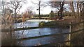


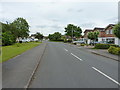
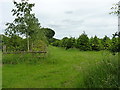
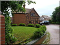
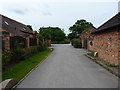
27 photos from this area
Area Information
Key information about the B90 2PT including its size, population, and administrative classification.
- Area Type
- Postcode
- Area Size
- 1.4 hectares
- Population
- 1574
- Population Density
- 4672 people/km²
House Prices in B90 2PT
30
Properties
£334,588
Average Sold Price
£83,000
Lowest Price
£715,000
Highest Price
Showing 30 properties
| Address | Type | Beds | Baths | Last Sale Price | Last Sale Date | |
|---|---|---|---|---|---|---|
| 54 Woodlands Lane, Shirley, Solihull, B90 2PT | Detached | 4 | 1 | £590,000 | Sep 2025 | |
| 32 Woodlands Lane, Shirley, Solihull, B90 2PT | house | - | - | £565,000 | May 2025 | |
| 42 Woodlands Lane, Shirley, Solihull, B90 2PT | house | - | - | £715,000 | Mar 2024 | |
| 4 Woodlands Lane, Shirley, Solihull, B90 2PT | Terraced | 3 | 1 | £356,000 | Jul 2023 | |
| 40 Woodlands Lane, Shirley, Solihull, B90 2PT | Detached | 3 | 1 | £405,000 | Oct 2020 | |
| 38 Woodlands Lane, Shirley, Solihull, B90 2PT | Detached | 4 | 2 | £396,000 | Apr 2018 | |
| 10A Woodlands Lane, Shirley, Solihull, B90 2PT | Bungalow | 3 | - | £352,500 | Jul 2015 | |
| 50 Woodlands Lane, Shirley, Solihull, B90 2PT | house | - | - | £325,000 | Jul 2014 | |
| 52 Woodlands Lane, Shirley, Solihull, B90 2PT | house | - | - | £330,000 | Sep 2012 | |
| 22 Woodlands Lane, Shirley, Solihull, B90 2PT | Bungalow | - | - | £247,000 | Oct 2011 |
Page 1 of 3
Energy Efficiency in B90 2PT
Amenities
Schools
| Rank | School | Type | Entry gender | Ages |
|---|
Explore more schools in this area
Go to Schools tabDemographics
Household Size
Family (3-5 people)
most common
Accommodation Type
Houses
most common
Tenure
91
majority
Ethnic Group
White
most common
Religion
N/A
most common
Household Composition
N/A
most common
Age
47
median
Adults (30-64 years)
most common
Household Deprivation
N/A
with no deprivation
NS-SEC
43
in Lower managerial occupations
Explore more demographic insights in this area
Go to Demographics tabPlanning
Planning Constraints
- Flood RiskPremium
- Ramsar Wetland SitesPremium
- Area of Outstanding Natural BeautyPremium
- Protected Nature ReservePremium
- Protected WoodlandPremium