Area Overview for B90 2NB
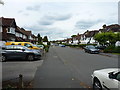
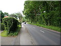
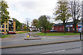
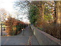
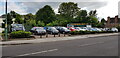
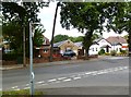
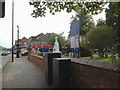
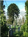
Photos of B90 2NB


Area Information
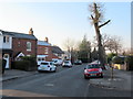
B90 2NB lies within Shirley West, a residential suburb in Solihull, West Midlands, historically rooted in farming but now a settled urban area. With a population of 1,666, it is a small, tightly knit community located approximately 3 miles southeast of Solihull town centre, along Stratford Road. The area is bordered by Yardley Wood in Birmingham to the north and Bromsgrove to the south, placing it at the edge of a broader suburban network. Daily life here is shaped by its proximity to motorways, rail links, and local amenities, while its history as a former farming settlement lingers in the landscape. Residents benefit from a mix of modern infrastructure and historical character, with Stratford Road serving as a key thoroughfare. The postcode’s compact size means it is a self-contained cluster, offering a quiet alternative to larger urban hubs. Its location near the M42 motorway and Birmingham International Airport ensures connectivity, though it retains a distinct local identity. For those seeking a balance between accessibility and community, B90 2NB provides a foundation of stability, with homes predominantly occupied by long-term residents.
- Area Type
- Postcode
- Area Size
- Not available
- Population
- 1666
- Population Density
- 4939 people/km²
The property market in B90 2NB is dominated by owner-occupied homes, with 87% of properties owned by residents rather than rented. This high rate of home ownership suggests a stable, long-term community with limited rental activity. The accommodation type is primarily houses, which is typical of suburban areas and may appeal to families seeking space and privacy. Given the small size of the postcode area, the housing stock is likely limited to a few hundred properties, making it a niche market. Buyers should consider the proximity to larger towns like Solihull and Birmingham, which offer additional amenities and employment opportunities. The predominance of houses may also indicate a focus on traditional, family-friendly homes, though the lack of specific data on property prices or types means potential buyers should conduct further local inquiries.
House Prices in B90 2NB
No properties found in this postcode.
Energy Efficiency in B90 2NB
Residents of B90 2NB have access to a range of amenities within practical reach. Retail options include Co-op Haslucks, Sainsburys Solihull Haslucks, and Aldi Shirley, providing everyday shopping needs. The area is served by multiple railway stations, including Shirley and Whitlocks End, facilitating travel to Birmingham and beyond. Nearby metro points, such as Birmingham International Airport and Grand Central New Street, add to the area’s connectivity. While specific parks or leisure facilities are not listed, the proximity to Stratford Road—a historic route—suggests potential for local walks or community events. The mix of retail, rail, and metro access supports a convenient lifestyle, though the absence of detailed leisure options means residents may need to travel further for recreational activities.
Amenities
Schools
Near B90 2NB are two schools: Burman Infant School, a primary school with an Ofsted rating of satisfactory, and Hazel Oak School, a special school. The presence of both a primary and special school suggests a range of educational options for families, though the absence of secondary schools may require commuting to nearby areas. Burman Infant School’s satisfactory rating indicates it meets acceptable standards, though it may not be among the top-performing schools in the region. Hazel Oak School caters to students with special educational needs, providing a vital service for families with such requirements. The mix of school types reflects the area’s demographic needs, though parents may need to look beyond B90 2NB for comprehensive schooling.
| Rank | School | Type | Entry gender | Ages |
|---|
Explore more schools in this area
Go to Schools tabDemographics
The population of B90 2NB has a median age of 47, with the majority of residents aged between 30 and 64. This suggests a community of working-age adults, many of whom may be established professionals or families with children. Home ownership is high, at 87%, indicating a stable, long-term resident base. The area is characterised by houses rather than flats, reflecting a preference for traditional family homes. The predominant ethnic group is White, though specific data on diversity is not provided. The absence of detailed deprivation statistics means that quality of life is likely influenced by the area’s low crime risk and access to amenities. With a median age skewed towards middle adulthood, the community may have a mature demographic profile, potentially supporting local services and schools. The high home ownership rate also suggests a lower turnover of residents, fostering a sense of continuity.
Household Size
Accommodation Type
Tenure
Ethnic Group
Religion
Household Composition
Age
Household Deprivation
NS-SEC
Explore more demographic insights in this area
Go to Demographics tabPlanning
Planning Constraints
- Flood RiskPremium
- Ramsar Wetland SitesPremium
- Area of Outstanding Natural BeautyPremium
- Protected Nature ReservePremium
- Protected WoodlandPremium