Area Overview for B90 2NA
Photos of B90 2NA


Area Information
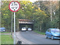
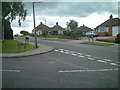
Living in B90 2NA, a small residential cluster in the Shirley area of Solihull, offers a blend of urban convenience and suburban calm. With a population of 1,540, this postcode area lies within Shirley South, an electoral ward historically rooted in rural Warwickshire but now a thriving residential suburb. The area is bisected by Stratford Road (A34), a historic turnpike that once hosted illicit activities but now connects residents to Solihull’s economic and cultural hubs. Daily life here is shaped by its proximity to commercial and distribution activities, including John Lewis logistics and retail at Marshall Lake. The area’s character is defined by its mix of office spaces, housing estates, and pockets of higher prosperity, such as Monkspath and Blossomfield. While the landscape is urban, remnants of its past linger, from the former Shirley racecourse now hosting a golf club to St James’ Church, built in 1832. For those seeking a balance between work and home, B90 2NA sits at the edge of Solihull’s network, offering access to amenities without the congestion of larger cities.
- Area Type
- Postcode
- Area Size
- Not available
- Population
- 1540
- Population Density
- 4423 people/km²
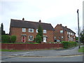
The property market in B90 2NA is dominated by owner-occupied homes, with 90% of residents living in houses rather than flats or rental properties. This high rate of home ownership suggests a community of long-term residents who have invested in their homes, likely prioritising stability and family living. The predominance of houses over other accommodation types indicates a market suited to families or individuals seeking private, spacious living. Given the small size of the area, the housing stock is likely limited, with properties concentrated in established estates or suburban developments. For buyers, this means a focus on existing homes rather than new builds, with potential for character properties reflecting the area’s historical roots. The tight-knit nature of the community, combined with high ownership rates, may create a competitive market, where availability is constrained by the small postcode area’s boundaries.
House Prices in B90 2NA
No properties found in this postcode.
Energy Efficiency in B90 2NA
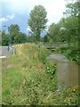
Residents of B90 2NA have access to a range of amenities within practical reach, enhancing daily convenience. The area is served by five retail outlets, including Sainsburys Solihull Haslucks, Co-op Haslucks, and Asda Solihull New, ensuring everyday shopping needs are met. Nearby rail stations like Shirley and Whitlocks End provide easy access to Birmingham and surrounding areas, while metro stations such as Grand Central New Street and Edgbaston Village connect to broader urban networks. For leisure, Marshall Lake park offers green space, and the historic Shirley Street once hosted inns like the Red Lion and Saracens Head. The area’s commercial focus includes distribution hubs and offices, reflecting its role in Solihull’s economy. While the landscape is urban, pockets of greenery and historical sites like St James’ Church add character. The mix of retail, transport, and historical features creates a lifestyle that balances practicality with a touch of local heritage.
Amenities
Schools
| Rank | School | Type | Entry gender | Ages |
|---|
Explore more schools in this area
Go to Schools tabDemographics
The community in B90 2NA is predominantly middle-aged, with a median age of 47 and the most common age range being adults aged 30–64. This suggests a mature, stable population, likely with established careers and families. Home ownership is exceptionally high at 90%, indicating a strong sense of long-term residency and investment in property. The area is characterised by houses rather than flats, reflecting a preference for private, family-oriented living. The predominant ethnic group is White, though no specific data on diversity or deprivation is provided. The age profile and ownership rates suggest a community focused on stability, with fewer young families or transient populations. Prosperity varies slightly, with eastern areas like Monkspath and Blossomfield showing higher economic activity compared to the periphery. This demographic profile aligns with the area’s role as a residential suburb with commercial underpinnings, where many residents work locally in offices or distribution hubs.
Household Size
Accommodation Type
Tenure
Ethnic Group
Religion
Household Composition
Age
Household Deprivation
NS-SEC
Explore more demographic insights in this area
Go to Demographics tabPlanning
Planning Constraints
- Flood RiskPremium
- Ramsar Wetland SitesPremium
- Area of Outstanding Natural BeautyPremium
- Protected Nature ReservePremium
- Protected WoodlandPremium