Area Overview for B90 2BP
Photos of B90 2BP

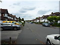
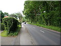
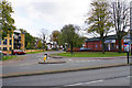
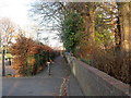
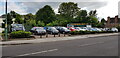
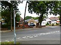

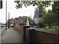


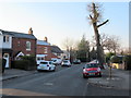
21 photos from this area
Area Information
Key information about the B90 2BP including its size, population, and administrative classification.
- Area Type
- Postcode
- Area Size
- 2.7 hectares
- Population
- 1540
- Population Density
- 4423 people/km²
House Prices in B90 2BP
56
Properties
£225,693
Average Sold Price
£2,250
Lowest Price
£539,500
Highest Price
Showing 56 properties
| Address | Type | Beds | Baths | Last Sale Price | Last Sale Date | |
|---|---|---|---|---|---|---|
| 67 Sansome Road, Shirley, Solihull, B90 2BP | Semi-detached | 3 | 1 | £475,000 | Sep 2025 | |
| 49 Sansome Road, Shirley, Solihull, B90 2BP | Maisonette | 2 | 1 | £93,000 | May 2024 | |
| 42 Sansome Road, Shirley, Solihull, B90 2BP | Semi-detached | 3 | 1 | £340,000 | Jul 2023 | |
| 85 Sansome Road, Shirley, Solihull, B90 2BP | house | 3 | - | £539,500 | Feb 2023 | |
| 57 Sansome Road, Shirley, Solihull, B90 2BP | house | - | - | £420,000 | Oct 2022 | |
| 45 Sansome Road, Shirley, Solihull, B90 2BP | Maisonette | 2 | 1 | £188,000 | Sep 2022 | |
| 43 Sansome Road, Shirley, Solihull, B90 2BP | Maisonette | 2 | 1 | £190,000 | Sep 2022 | |
| 70 Sansome Road, Shirley, Solihull, B90 2BP | house | - | - | £430,600 | Jun 2022 | |
| 68 Sansome Road, Shirley, Solihull, B90 2BP | Detached | 4 | 1 | £425,000 | Nov 2021 | |
| 30 Sansome Road, Shirley, Solihull, B90 2BP | house | - | - | £283,000 | Sep 2021 |
Page 1 of 6
Energy Efficiency in B90 2BP
Amenities
Schools
| Rank | School | Type | Entry gender | Ages |
|---|
Explore more schools in this area
Go to Schools tabDemographics
Household Size
Family (3-5 people)
most common
Accommodation Type
Houses
most common
Tenure
90
majority
Ethnic Group
White
most common
Religion
N/A
most common
Household Composition
N/A
most common
Age
47
median
Adults (30-64 years)
most common
Household Deprivation
N/A
with no deprivation
NS-SEC
40
in Lower managerial occupations
Explore more demographic insights in this area
Go to Demographics tabPlanning
Planning Constraints
- Flood RiskPremium
- Ramsar Wetland SitesPremium
- Area of Outstanding Natural BeautyPremium
- Protected Nature ReservePremium
- Protected WoodlandPremium