Area Overview for B90 2BF
Photos of B90 2BF


Area Information
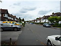
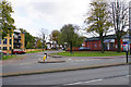
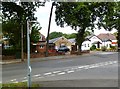
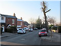
Living in B90 2BF means being part of a small, tightly knit residential cluster in Shirley, a suburb of Solihull, West Midlands. The area is situated approximately 3 miles southeast of Solihull town centre, along Stratford Road, with easy access to the M42 motorway, which links to Birmingham and Stratford-upon-Avon. With a population of 1,666, it is a compact community characterised by a mix of historical and modern features. The area’s roots trace back to the 13th century, when it was known as ‘Syrley’ and part of the Manor of Ulverlei. Today, it balances its heritage with contemporary amenities, including retail outlets, rail connections, and proximity to Birmingham International Airport. The median age of 47 suggests a mature, stable population, with many residents in the 30–64 age range. Daily life here is shaped by its suburban setting, offering a blend of quiet residential streets and practical access to urban services, making it appealing to families and professionals seeking a balance between convenience and tranquillity.
- Area Type
- Postcode
- Area Size
- Not available
- Population
- 1666
- Population Density
- Not available
The property market in B90 2BF is dominated by owner-occupied homes, with 87% of properties owned by residents rather than rented. This high home ownership rate indicates a stable, long-term community with little turnover, which can be attractive to buyers seeking a settled environment. The accommodation type is primarily houses, reflecting the area’s suburban nature and suggesting a focus on family-friendly living. Given the small size of the postcode area, the housing stock is likely limited, meaning buyers may need to consider nearby suburbs for more options. The presence of houses rather than flats or apartments implies a preference for private, spacious living, which could appeal to those prioritising garden space or home security. However, the limited number of properties also means competition may be fierce, and buyers should act promptly to secure a home in this sought-after area.
House Prices in B90 2BF
No properties found in this postcode.
Energy Efficiency in B90 2BF
The lifestyle in B90 2BF is shaped by its proximity to a range of amenities, from retail to transport. Local shops include Co-op Haslucks, Sainsburys Solihull Haslucks, and Aldi Shirley, providing everyday essentials within walking or short driving distance. The area’s rail network is well-developed, with stations like Shirley and Whitlocks End offering frequent services to Birmingham and surrounding areas. Nearby, Birmingham International Airport is within reach, facilitating travel for both business and leisure. While the data does not mention parks or leisure facilities directly, the area’s suburban character suggests access to green spaces, as is common in similar postcode clusters. The mix of retail and transport options creates a convenient lifestyle, allowing residents to balance local convenience with urban connectivity. This accessibility to shops, transport, and airports makes daily life practical and efficient for families and commuters alike.
Amenities
Schools
Residents of B90 2BF have access to two notable schools within practical reach. Burman Infant School is a primary school with an Ofsted rating of satisfactory, providing early education for young children. Hazel Oak School is a special school, catering to students with specific educational needs. This combination of school types suggests a diverse educational landscape, with options for both mainstream and specialist education. The presence of a primary school is particularly valuable for families with young children, reducing the need for long commutes. However, the data does not mention secondary schools, so parents may need to look further afield for comprehensive schooling. The availability of a special school indicates the area’s commitment to inclusive education, though families with older children may need to consider nearby districts for secondary education.
| Rank | School | Type | Entry gender | Ages |
|---|
Explore more schools in this area
Go to Schools tabDemographics
The community in B90 2BF is predominantly composed of adults aged 30–64, with a median age of 47. This suggests a mature population, likely with established careers and families. Home ownership is high at 87%, indicating a stable, long-term resident base rather than a transient rental market. The accommodation type is primarily houses, which aligns with the area’s suburban character and suggests a focus on family homes. The predominant ethnic group is White, reflecting broader demographic trends in the region. While specific data on deprivation is not provided, the area is described as less prosperous than some neighbouring parts of Shirley but without the extreme deprivation seen in Shirley East. This context implies a moderate quality of life, with access to essential services but limited high-end amenities. The demographic profile suggests a community that values stability, with residents likely prioritising proximity to schools, transport, and local amenities.
Household Size
Accommodation Type
Tenure
Ethnic Group
Religion
Household Composition
Age
Household Deprivation
NS-SEC
Explore more demographic insights in this area
Go to Demographics tabPlanning
Planning Constraints
- Flood RiskPremium
- Ramsar Wetland SitesPremium
- Area of Outstanding Natural BeautyPremium
- Protected Nature ReservePremium
- Protected WoodlandPremium