Area Overview for B90 2AX
Photos of B90 2AX

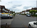
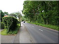
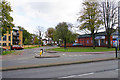
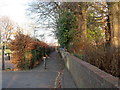


21 photos from this area
Area Information
Key information about the B90 2AX including its size, population, and administrative classification.
- Area Type
- Postcode
- Area Size
- 1.4 hectares
- Population
- 1247
- Population Density
- 3497 people/km²
House Prices in B90 2AX
16
Properties
£202,785
Average Sold Price
£67,000
Lowest Price
£445,000
Highest Price
Showing 16 properties
| Address | Type | Beds | Baths | Last Sale Price | Last Sale Date | |
|---|---|---|---|---|---|---|
| 27 Church Road, Shirley, Solihull, B90 2AX | Detached | 3 | 2 | £445,000 | Aug 2023 | |
| 23 Church Road, Shirley, Solihull, B90 2AX | house | - | - | £282,500 | Jul 2021 | |
| 31 Church Road, Shirley, Solihull, B90 2AX | Semi-detached | 4 | 2 | £245,000 | Aug 2019 | |
| 33 Church Road, Shirley, Solihull, B90 2AX | Detached | - | - | £325,000 | Nov 2006 | |
| 18 Church Road, Shirley, Solihull, B90 2AX | Semi-detached | - | - | £180,000 | Nov 2005 | |
| 14 Church Road, Shirley, Solihull, B90 2AX | Semi-detached | - | - | £184,950 | May 2004 | |
| 12 Church Road, Shirley, Solihull, B90 2AX | house | - | - | £129,950 | Jun 2002 | |
| 16 Church Road, Shirley, Solihull, B90 2AX | Semi-detached | 4 | 1 | £89,500 | Jun 1997 | |
| 29 Church Road, Shirley, Solihull, B90 2AX | Semi-detached | - | - | £78,950 | May 1997 | |
| 20 Church Road, Shirley, Solihull, B90 2AX | house | - | - | £67,000 | May 1997 |
Page 1 of 2
Energy Efficiency in B90 2AX
Amenities
Schools
| Rank | School | Type | Entry gender | Ages |
|---|
Explore more schools in this area
Go to Schools tabDemographics
Household Size
Family (3-5 people)
most common
Accommodation Type
Houses
most common
Tenure
73
majority
Ethnic Group
White
most common
Religion
N/A
most common
Household Composition
N/A
most common
Age
47
median
Adults (30-64 years)
most common
Household Deprivation
N/A
with no deprivation
NS-SEC
34
in Lower managerial occupations
Explore more demographic insights in this area
Go to Demographics tabPlanning
Planning Constraints
- Flood RiskPremium
- Ramsar Wetland SitesPremium
- Area of Outstanding Natural BeautyPremium
- Protected Nature ReservePremium
- Protected WoodlandPremium