Area Overview for B90 2AU
Photos of B90 2AU


Area Information
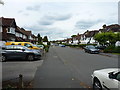
Living in B90 2AU means being part of a small, tightly knit residential cluster in the Shirley West ward of Solihull, West Midlands. With a population of 1,666, this area is compact yet historically rich, tracing its roots to a farming settlement that evolved into a suburban hub. Situated approximately 3 miles southeast of Solihull town centre along Stratford Road, it lies at the crossroads of Birmingham, Bromsgrove, and Yardley Wood. The area’s character is shaped by its proximity to the M42 motorway, offering easy access to Stratford-upon-Avon and Birmingham. Daily life here balances suburban tranquillity with urban connectivity, with residents benefiting from nearby rail links, retail outlets, and a low crime rate. The postcode covers a mix of older housing stock and post-war developments, reflecting its growth over centuries. For those seeking a stable, family-oriented environment with practical transport options, B90 2AU offers a blend of historical charm and modern convenience.
- Area Type
- Postcode
- Area Size
- Not available
- Population
- 1666
- Population Density
- 4939 people/km²
The property market in B90 2AU is dominated by owner-occupied homes, with 87% of properties in private hands. This high rate of home ownership suggests a stable market with limited rental activity, making it less common to find available properties for short-term lets. The accommodation type is primarily houses, which contrasts with areas where flats or apartments dominate. This housing stock appeals to families seeking spacious, traditional homes, though the small size of the postcode means the overall inventory is limited. Buyers should consider the proximity to nearby areas like Yardley Wood and Solihull, where additional options may exist. The focus on owner-occupation also implies that properties here are likely to be long-term investments rather than speculative purchases. For those prioritising property stability, B90 2AU offers a reliable, low-turnover market.
House Prices in B90 2AU
No properties found in this postcode.
Energy Efficiency in B90 2AU
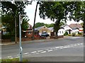
Residents of B90 2AU enjoy a range of amenities within practical reach, from retail to transport hubs. The area is served by five retail outlets, including Sainsburys Solihull Haslucks, Co-op Haslucks, and Aldi Shirley, ensuring everyday shopping needs are met. Nearby rail stations such as Shirley and Yardley Wood connect to Birmingham’s transport network, while the M42 motorway provides swift access to regional destinations. The proximity to Birmingham International Airport and Grand Central New Street further enhances connectivity. The mix of retail, transport, and road links fosters a convenient lifestyle, balancing suburban comfort with urban accessibility. Though the area lacks detailed data on parks or leisure facilities, its strategic positioning ensures residents can easily access broader Solihull amenities.
Amenities
Schools
Residents of B90 2AU have access to two notable schools: Burman Infant School, a primary school with a satisfactory Ofsted rating, and Hazel Oak School, a special needs institution. Burman Infant School’s rating indicates it meets acceptable standards for early education, though it does not exceed them. Hazel Oak’s presence highlights the area’s capacity to support children with specific educational requirements. The combination of a primary school and a special school suggests a comprehensive educational offering for families, though no secondary schools are listed in the data. This mix may be advantageous for parents seeking tailored support for their children but could limit options for those requiring a broader range of school types. The proximity of these institutions to residential areas ensures convenient access for families.
| Rank | School | Type | Entry gender | Ages |
|---|
Explore more schools in this area
Go to Schools tabDemographics
The community in B90 2AU is predominantly composed of adults aged 30–64, with a median age of 47. This suggests a mature population, likely with established careers and families. Home ownership is exceptionally high at 87%, indicating a stable, long-term resident base. The area is characterised by houses rather than flats, reflecting a preference for traditional, family-sized properties. The predominant ethnic group is White, though specific data on other demographics is not provided. The absence of detailed diversity statistics means the area’s cultural composition remains less defined. The relatively low population size and high home ownership suggest a cohesive, low-deprivation community, though broader Solihull areas like Shirley East face more pronounced deprivation. This profile aligns with a neighbourhood where quality of life is supported by stable housing and limited rental demand.
Household Size
Accommodation Type
Tenure
Ethnic Group
Religion
Household Composition
Age
Household Deprivation
NS-SEC
Explore more demographic insights in this area
Go to Demographics tabPlanning
Planning Constraints
- Flood RiskPremium
- Ramsar Wetland SitesPremium
- Area of Outstanding Natural BeautyPremium
- Protected Nature ReservePremium
- Protected WoodlandPremium