Area Overview for B90 1TR
Photos of B90 1TR


Area Information
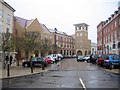
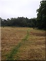
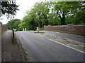
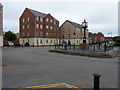
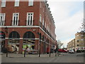
Dickens Heath represents a distinct planned settlement within the Solihull borough, situated near the historic Warwickshire border. The postcode B90 1TR covers a specific residential cluster encompassing an area of 1401 square metres, home to a population of 1561 people. This locality was developed from the late 1990s as a deliberate alternative to conventional housing estates. Architects designed the layout to emulate a traditional village, incorporating mixed-use commercial and employment facilities alongside living spaces. The result is a suburb with a cohesive identity rather than a dispersed collection of homes. Residents enjoy access to a village green, a country park, and a nature reserve integrated directly into the community fabric. A village hall, library, and medical centre anchor the daily rhythm of life here. The area allows you to walk to schools and shops without needing a car for routine errands. While the modern development feels new, it draws on local history, with the name derived from Thomas Dykens who lived in the district in 1524. The layout features angular roundabouts and a village clock, contributing to a sense of place that remains consistent year-round. You are living in an area where infrastructure supports both commercial activity and residential peace.
- Area Type
- Postcode
- Area Size
- 1401 m²
- Population
- 1561
- Population Density
- 9547 people/km²
The property market in B90 1TR displays clear characteristics due to its managed development history. Over 54% of residents own their homes, establishing this as primarily an owner-occupied area rather than a high-rental zone. Such a high ownership percentage often means property values remain stable as owners resist selling against their personal best interests. The predominant accommodation type consists of flats, which differs from the typical suburban streets lined with houses you might find elsewhere in Solihull. This layout fits the planned village model where vertical living shares space with ground-level commercial amenities. When you consider homes in B90 1TR, you are looking at units within a structured community designed from the 1990s to function as an integrated whole. The surrounding borough includes thousands of new homes, but this specific postcode focuses on dense, mixed-use living. You benefit from a market where supply is limited by the bounded nature of the development. This scarcity can protect price appreciations over time. Buyers here should expect a neighbourhood where the architecture supports a walkable lifestyle rather than car-dependent sprawl. The mix of ownership and accommodation types ensures a predictable housing stock with little sudden change.
House Prices in B90 1TR
Showing 12 properties
| Address | Type | Beds | Baths | Last Sale Price | Last Sale Date | |
|---|---|---|---|---|---|---|
| 20 Mereways, Dickens Heath, Solihull, B90 1TR | Flat | - | - | £184,000 | Apr 2024 | |
| 2 Mereways, Dickens Heath, Solihull, B90 1TR | Flat | - | - | £159,000 | Jul 2022 | |
| 8 Mereways, Dickens Heath, Solihull, B90 1TR | Flat | - | - | £175,000 | Feb 2022 | |
| 12 Mereways, Dickens Heath, Solihull, B90 1TR | Flat | - | - | £180,000 | Oct 2021 | |
| 6 Mereways, Dickens Heath, Solihull, B90 1TR | Flat | - | - | £178,000 | Nov 2019 | |
| 16 Mereways, Dickens Heath, Solihull, B90 1TR | Flat | - | - | £157,000 | Oct 2019 | |
| 24 Mereways, Dickens Heath, Solihull, B90 1TR | Flat | - | - | £173,500 | Oct 2017 | |
| 4 Mereways, Dickens Heath, Solihull, B90 1TR | Flat | 2 | - | £157,000 | Apr 2017 | |
| 14 Mereways, Dickens Heath, Solihull, B90 1TR | Flat | - | - | £148,500 | Sep 2016 | |
| 18 Mereways, Dickens Heath, Solihull, B90 1TR | Flat | - | - | £192,000 | Mar 2016 |
Energy Efficiency in B90 1TR
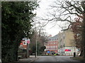
Daily life in B90 1TR centres on a cluster of specific retail and transport amenities located within practical reach. You have immediate access to five major retail outlets spanning the high street and nearby shopping zones. Tesco Shirley, Sainsburys Marshall, and M&S Sears sit among the five notable shops you will encounter. These supermarkets cover all your grocery and weekly shopping needs without a long commute. For travel, you do not need to venture far to reach the rail network. Five rail stations serve the immediate vicinity, including Whitlocks End, Wythall, and Shirley Railway Station. You can reach Newton Heath or Birmingham from these stops, making regular city centre trips manageable. The lifestyle here blends modern convenience with planned community features. You might visit the village hall for events or the library for quiet study. The High Street offers dining and offices, supporting the local economy. Nature lovers can utilise the country park and nature reserve that define the border of the settlement. You live in a place where evening walks lead to lit high streets or green spaces rather than empty highways.
Amenities
Schools
| Rank | School | Type | Entry gender | Ages |
|---|
Explore more schools in this area
Go to Schools tabDemographics
Understanding the community in B90 1TR requires looking at the specific age and ownership profile of its 1561 residents. The median age is 47 years, indicating that the most common age range consists of adults between 30 and 64 years old. This demographic skew suggests the area attracts families seeking stability rather than young professionals or retirees moving for leisure. Over 54% of households in B90 1TR are owner-occupied, meaning a majority of people own their homes outright or have a significant mortgage stake. This high ownership rate typically correlates with long-term community investment and stability. The predominant ethnic group is White, reflecting the broader demographic trends of the region. Accommodation within this postcode is primarily composed of flats, which distinguishes it from areas dominated by detached or semi-detached houses. This housing type suggests a design focused on density and shared spaces within the planned village concept. You are not buying into a transient rental market but rather settling in a place where residents tend to stay for decades. The combination of a mature age profile and high ownership levels creates a neighbourhood where neighbours know each other well and local issues take priority.
Household Size
Accommodation Type
Tenure
Ethnic Group
Religion
Household Composition
Age
Household Deprivation
NS-SEC
Explore more demographic insights in this area
Go to Demographics tabPlanning
Planning Constraints
- Flood RiskPremium
- Ramsar Wetland SitesPremium
- Area of Outstanding Natural BeautyPremium
- Protected Nature ReservePremium
- Protected WoodlandPremium