Area Overview for B90 1TB
Photos of B90 1TB

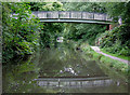


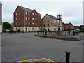
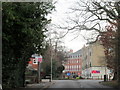
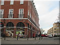
47 photos from this area
Area Information
Key information about the B90 1TB including its size, population, and administrative classification.
- Area Type
- Postcode
- Area Size
- 1.1 hectares
- Population
- 2761
- Population Density
- 453 people/km²
House Prices in B90 1TB
36
Properties
£509,313
Average Sold Price
£375,000
Lowest Price
£735,000
Highest Price
Showing 36 properties
| Address | Type | Beds | Baths | Last Sale Price | Last Sale Date | |
|---|---|---|---|---|---|---|
| 14 Hutchings Lane, Dickens Heath, Solihull, B90 1TB | house | - | - | £640,000 | Dec 2020 | |
| 2 Hutchings Lane, Dickens Heath, Solihull, B90 1TB | Detached | 4 | 1 | £735,000 | Oct 2019 | |
| 6 Hutchings Lane, Dickens Heath, Solihull, B90 1TB | Detached | 4 | 3 | £475,000 | Oct 2014 | |
| 8 Hutchings Lane, Dickens Heath, Solihull, B90 1TB | house | 6 | - | £493,500 | Jul 2010 | |
| 16 Hutchings Lane, Dickens Heath, Solihull, B90 1TB | Flat | 1 | 1 | £435,000 | Dec 2004 | |
| 12 Hutchings Lane, Dickens Heath, Solihull, B90 1TB | Detached | - | - | £491,000 | Oct 2004 | |
| 10 Hutchings Lane, Dickens Heath, Solihull, B90 1TB | house | - | - | £430,000 | Jun 2003 | |
| 4 Hutchings Lane, Dickens Heath, Solihull, B90 1TB | Detached | - | - | £375,000 | Dec 2002 | |
| Apartment 71, Cornwood House, 16 Hutchings Lane, Dickens Heath, Solihull, B90 1TB | Flat | 1 | 1 | - | - | |
| Apartment 88, Cornwood House, 16 Hutchings Lane, Dickens Heath, Solihull, B90 1TB | Flat | 2 | 2 | - | - |
Page 1 of 4
Energy Efficiency in B90 1TB
Amenities
Schools
| Rank | School | Type | Entry gender | Ages |
|---|
Explore more schools in this area
Go to Schools tabDemographics
Household Size
Family (3-5 people)
most common
Accommodation Type
Houses
most common
Tenure
76
majority
Ethnic Group
White
most common
Religion
N/A
most common
Household Composition
N/A
most common
Age
47
median
Adults (30-64 years)
most common
Household Deprivation
N/A
with no deprivation
NS-SEC
53
in Lower managerial occupations
Explore more demographic insights in this area
Go to Demographics tabPlanning
Planning Constraints
- Flood RiskPremium
- Ramsar Wetland SitesPremium
- Area of Outstanding Natural BeautyPremium
- Protected Nature ReservePremium
- Protected WoodlandPremium