Area Overview for B90 1NX
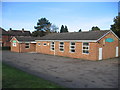
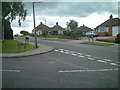
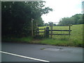
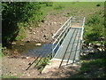
Photos of B90 1NX


Area Information
Living in B90 1NX means being part of a small, residential cluster in the heart of Shirley West, a suburb of Solihull, West Midlands. With a population of 2,009, this area is compact yet connected to the broader Shirley neighbourhood, historically rooted in farming but now a settled residential community. Positioned approximately 3 miles southeast of Solihull town centre, it lies along Stratford Road, a key arterial link to Birmingham and Stratford-upon-Avon. Proximity to the M42 motorway ensures easy access to major cities, while nearby railway stations like Shirley and Yardley Wood offer commuter routes. The area’s character blends suburban tranquillity with practical connectivity, making it appealing for those seeking a balance between local convenience and regional accessibility. Residents benefit from a mix of retail, transport, and educational facilities, all within a short reach, while the area’s low crime rate and minimal environmental constraints contribute to a stable, secure living environment.
- Area Type
- Postcode
- Area Size
- Not available
- Population
- 2009
- Population Density
- 4350 people/km²
The property market in B90 1NX is characterised by a high rate of home ownership (73%) and a focus on houses as the primary accommodation type. This suggests a market skewed towards owner-occupied properties rather than rentals, likely attracting buyers seeking family homes or long-term stability. The concentration of houses may indicate a mix of semi-detached, detached, or terraced properties, typical of suburban areas. Given the small size of the postcode area, the housing stock is limited, which could mean higher competition among buyers. For those considering the area, the emphasis on owner-occupation and the presence of established homes may appeal to those prioritising security and investment potential, though the narrow scope of the postcode means buyers should look beyond it to surrounding suburbs for broader options.
House Prices in B90 1NX
No properties found in this postcode.
Energy Efficiency in B90 1NX
The lifestyle in B90 1NX is supported by a range of nearby amenities, including retail outlets like Asda Solihull New, Sainsburys Solihull Haslucks, and Co-op Haslucks, which provide everyday shopping needs. The area’s proximity to rail and metro stations—such as Shirley, Whitlocks End, and Grand Central New Street—offers convenient access to urban centres and employment hubs. While the data does not specify parks or leisure facilities, the historical context of Shirley suggests a mix of suburban and semi-rural character, potentially offering green spaces for recreation. The combination of retail, transport, and connectivity creates a practical living environment, ideal for those valuing convenience without sacrificing access to regional opportunities.
Amenities
Schools
The nearest school to B90 1NX is Mill Lodge Primary School, a primary institution with an Ofsted rating of ‘good’. This school serves the local community, offering education for younger children and contributing to the area’s appeal for families. The absence of secondary schools in the immediate vicinity means parents may need to consider nearby suburbs or commuting to larger towns for secondary education. However, the presence of a well-rated primary school is a significant asset, providing a foundation for local children’s education. The school’s rating suggests it meets acceptable standards in teaching and facilities, though families with older children may need to plan for additional travel.
| Rank | School | Type | Entry gender | Ages |
|---|
Explore more schools in this area
Go to Schools tabDemographics
The community in B90 1NX is predominantly composed of adults aged 30–64, with a median age of 47. This suggests a mature, established population, many of whom are likely long-term residents. Home ownership is high at 73%, indicating a strong presence of owner-occupied properties, which often correlates with stability and long-term investment. The accommodation type is primarily houses, reflecting a preference for family homes or larger dwellings. The predominant ethnic group is White, though no specific diversity statistics are provided. The area is described as less prosperous than some surrounding suburbs but avoids the extremes of deprivation seen in parts of Shirley East. This context implies a moderate quality of life, with access to essential services and a community that is neither overly affluent nor significantly deprived.
Household Size
Accommodation Type
Tenure
Ethnic Group
Religion
Household Composition
Age
Household Deprivation
NS-SEC
Explore more demographic insights in this area
Go to Demographics tabPlanning
Planning Constraints
- Flood RiskPremium
- Ramsar Wetland SitesPremium
- Area of Outstanding Natural BeautyPremium
- Protected Nature ReservePremium
- Protected WoodlandPremium