Area Overview for B90 1HE
Photos of B90 1HE
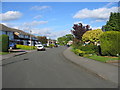

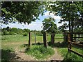
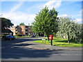
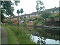
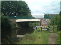
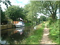


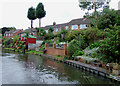
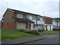
41 photos from this area
Area Information
Key information about the B90 1HE including its size, population, and administrative classification.
- Area Type
- Postcode
- Area Size
- 6333 m²
- Population
- 2009
- Population Density
- 4350 people/km²
House Prices in B90 1HE
13
Properties
£218,217
Average Sold Price
£85,000
Lowest Price
£363,000
Highest Price
Showing 13 properties
| Address | Type | Beds | Baths | Last Sale Price | Last Sale Date | |
|---|---|---|---|---|---|---|
| 125 Myton Drive, Solihull Lodge, Solihull, B90 1HE | Semi-detached | 3 | 1 | £363,000 | Oct 2023 | |
| 109 Myton Drive, Solihull Lodge, Solihull, B90 1HE | Semi-detached | 3 | 1 | £275,000 | Apr 2019 | |
| 113 Myton Drive, Solihull Lodge, Solihull, B90 1HE | Semi-detached | 3 | 1 | £284,000 | Nov 2018 | |
| 105 Myton Drive, Solihull Lodge, Solihull, B90 1HE | house | - | - | £228,000 | Aug 2010 | |
| 129 Myton Drive, Solihull Lodge, Solihull, B90 1HE | house | - | - | £216,000 | Oct 2005 | |
| 121 Myton Drive, Solihull Lodge, Solihull, B90 1HE | Semi-detached | - | - | £195,000 | Sep 2005 | |
| 107 Myton Drive, Solihull Lodge, Solihull, B90 1HE | Semi-detached | 3 | 1 | £186,000 | Aug 2004 | |
| 123 Myton Drive, Solihull Lodge, Solihull, B90 1HE | Detached | - | - | £131,950 | Aug 2001 | |
| 119 Myton Drive, Solihull Lodge, Solihull, B90 1HE | Semi-detached | - | - | £85,000 | Aug 1998 | |
| 127 Myton Drive, Solihull Lodge, Solihull, B90 1HE | Semi-detached | 3 | 2 | - | - |
Page 1 of 2
Energy Efficiency in B90 1HE
Amenities
Schools
| Rank | School | Type | Entry gender | Ages |
|---|
Explore more schools in this area
Go to Schools tabDemographics
Household Size
One person
most common
Accommodation Type
Houses
most common
Tenure
73
majority
Ethnic Group
White
most common
Religion
N/A
most common
Household Composition
N/A
most common
Age
47
median
Adults (30-64 years)
most common
Household Deprivation
N/A
with no deprivation
NS-SEC
40
in Lower managerial occupations
Explore more demographic insights in this area
Go to Demographics tabPlanning
Planning Constraints
- Flood RiskPremium
- Ramsar Wetland SitesPremium
- Area of Outstanding Natural BeautyPremium
- Protected Nature ReservePremium
- Protected WoodlandPremium