Area Overview for B90 1EX
Photos of B90 1EX
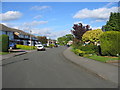
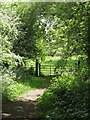
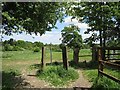
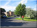
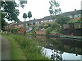
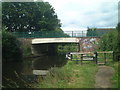
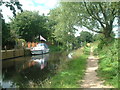

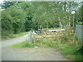
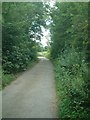
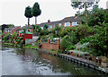
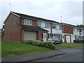
41 photos from this area
Area Information
Key information about the B90 1EX including its size, population, and administrative classification.
- Area Type
- Postcode
- Area Size
- 1.7 hectares
- Population
- 1386
- Population Density
- 4509 people/km²
House Prices in B90 1EX
43
Properties
£206,257
Average Sold Price
£56,500
Lowest Price
£460,000
Highest Price
Showing 43 properties
| Address | Type | Beds | Baths | Last Sale Price | Last Sale Date | |
|---|---|---|---|---|---|---|
| 7 Lawford Grove, Solihull Lodge, Solihull, B90 1EX | Semi-detached | 3 | 1 | £278,000 | Jun 2024 | |
| 43 Lawford Grove, Solihull Lodge, Solihull, B90 1EX | Detached | 3 | 2 | £460,000 | Dec 2022 | |
| 27 Lawford Grove, Solihull Lodge, Solihull, B90 1EX | Semi-detached | 3 | 1 | £222,500 | May 2021 | |
| 25 Lawford Grove, Solihull Lodge, Solihull, B90 1EX | Semi-detached | 3 | 1 | £273,500 | Jan 2020 | |
| 22 Lawford Grove, Solihull Lodge, Solihull, B90 1EX | Detached | 4 | 1 | £375,000 | Oct 2018 | |
| 14 Lawford Grove, Solihull Lodge, Solihull, B90 1EX | Semi-detached | - | - | £210,000 | Jun 2018 | |
| 20 Lawford Grove, Solihull Lodge, Solihull, B90 1EX | Detached | 3 | 2 | £305,000 | Dec 2017 | |
| 39 Lawford Grove, Solihull Lodge, Solihull, B90 1EX | Semi-detached | 4 | 2 | £340,000 | Nov 2015 | |
| 19 Lawford Grove, Solihull Lodge, Solihull, B90 1EX | Semi-detached | 3 | 1 | £219,950 | Sep 2014 | |
| 33 Lawford Grove, Solihull Lodge, Solihull, B90 1EX | house | 3 | - | £201,450 | Oct 2011 |
Page 1 of 5
Energy Efficiency in B90 1EX
Amenities
Schools
| Rank | School | Type | Entry gender | Ages |
|---|
Explore more schools in this area
Go to Schools tabDemographics
Household Size
Two person
most common
Accommodation Type
Houses
most common
Tenure
80
majority
Ethnic Group
White
most common
Religion
N/A
most common
Household Composition
N/A
most common
Age
47
median
Adults (30-64 years)
most common
Household Deprivation
N/A
with no deprivation
NS-SEC
36
in Lower managerial occupations
Explore more demographic insights in this area
Go to Demographics tabPlanning
Planning Constraints
- Flood RiskPremium
- Ramsar Wetland SitesPremium
- Area of Outstanding Natural BeautyPremium
- Protected Nature ReservePremium
- Protected WoodlandPremium