Area Overview for B90 1AS
Photos of B90 1AS


Area Information
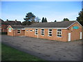
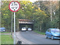
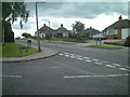
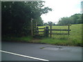
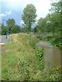
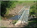
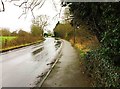
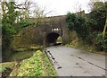
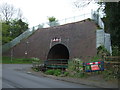
Living in B90 1AS means being part of Shirley West, a small residential cluster in Solihull’s west end, just 3 miles from the town centre. This area, with a population of 1,569, sits along Stratford Road, bordered by Birmingham’s Yardley Wood to the north and Bromsgrove to the south. Historically a farming settlement, it evolved into a suburban hub with post-war housing developments like the Cranmore estate. The community is defined by its proximity to the M42 motorway, offering easy access to Birmingham and Stratford-upon-Avon. Daily life here balances suburban tranquillity with urban connectivity, with nearby rail links and retail options. While not as affluent as some surrounding areas, B90 1AS avoids extremes of deprivation, making it a stable, low-risk place to live. Its character is shaped by historic sites like St James’ Church and the Iron Age Berry Mound, alongside modern amenities that cater to a predominantly middle-aged, home-owning population.
- Area Type
- Postcode
- Area Size
- Not available
- Population
- 1569
- Population Density
- 4395 people/km²
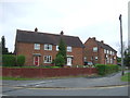
The property market in B90 1AS is dominated by owner-occupied homes, with 82% of properties in private hands. This suggests a community of long-term residents rather than a transient rental market. The area’s accommodation is primarily houses, which is typical of suburban zones with lower population density. Given the small size of the postcode area, the housing stock is limited, meaning buyers may need to consider nearby wards for more options. The prevalence of owner-occupation indicates stable property values and a focus on family homes. However, the lack of flats or high-density housing means the market may not appeal to those seeking urban living or investment opportunities in rental properties. For buyers, this area offers a mix of traditional housing with a lower risk of speculative price swings.
House Prices in B90 1AS
No properties found in this postcode.
Energy Efficiency in B90 1AS
Residents of B90 1AS have access to a range of nearby amenities, including five retail outlets such as Sainsburys Solihull Haslucks, Asda Solihull New, and Co-op Haslucks. These shops provide everyday essentials, while the area’s rail network—comprising Shirley, Yardley Wood, and Whitlocks End stations—offers convenient links to Birmingham and surrounding towns. The metro stations at Grand Central New Street, Corporation Street, and Edgbaston Village further expand mobility options. Though the area itself is small, its proximity to Stratford Road and the M42 ensures access to broader leisure and cultural opportunities. The presence of historic sites like St James’ Church and the Shirley Golf Club adds character, blending suburban convenience with local heritage. These amenities support a balanced lifestyle, combining practicality with community identity.
Amenities
Schools
| Rank | School | Type | Entry gender | Ages |
|---|
Explore more schools in this area
Go to Schools tabDemographics
The residents of B90 1AS are predominantly adults aged 30–64, with a median age of 47. Eighty-two per cent of homes are owner-occupied, reflecting a community rooted in long-term residency rather than rental turnover. The area is characterised by houses rather than flats, aligning with its suburban identity. The predominant ethnic group is White, though no specific diversity metrics are provided. The ward is less prosperous than some parts of Solihull but avoids the higher deprivation seen in Shirley East. This demographic profile suggests a mature, stable population with established family ties, likely prioritising home ownership and local amenities. The absence of significant deprivation indicators implies a moderate quality of life, with access to services and transport networks that support daily needs.
Household Size
Accommodation Type
Tenure
Ethnic Group
Religion
Household Composition
Age
Household Deprivation
NS-SEC
Explore more demographic insights in this area
Go to Demographics tabPlanning
Planning Constraints
- Flood RiskPremium
- Ramsar Wetland SitesPremium
- Area of Outstanding Natural BeautyPremium
- Protected Nature ReservePremium
- Protected WoodlandPremium
- Crime RiskPremium