Area Overview for B90 1AD
Photos of B90 1AD
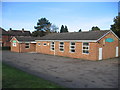
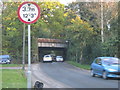
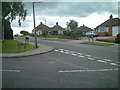
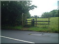
59 photos from this area
Area Information
Key information about the B90 1AD including its size, population, and administrative classification.
- Area Type
- Postcode
- Area Size
- 3.7 hectares
- Population
- 1569
- Population Density
- 4395 people/km²
House Prices in B90 1AD
53
Properties
£197,241
Average Sold Price
£50,000
Lowest Price
£335,500
Highest Price
Showing 53 properties
| Address | Type | Beds | Baths | Last Sale Price | Last Sale Date | |
|---|---|---|---|---|---|---|
| 30 Cole Green, Shirley, Solihull, B90 1AD | Semi-detached | 3 | 1 | £335,500 | Jan 2025 | |
| 14 Cole Green, Shirley, Solihull, B90 1AD | house | - | - | £240,000 | Apr 2022 | |
| 42 Cole Green, Shirley, Solihull, B90 1AD | house | - | - | £245,000 | Nov 2021 | |
| 8 Cole Green, Shirley, Solihull, B90 1AD | house | - | - | £295,000 | Sep 2021 | |
| 60 Cole Green, Shirley, Solihull, B90 1AD | Semi-detached | 3 | 1 | £235,000 | Feb 2020 | |
| 24 Cole Green, Shirley, Solihull, B90 1AD | house | - | - | £240,000 | Jan 2020 | |
| 62 Cole Green, Shirley, Solihull, B90 1AD | house | - | - | £270,000 | Apr 2019 | |
| 58 Cole Green, Shirley, Solihull, B90 1AD | Semi-detached | 3 | 1 | £253,500 | Dec 2018 | |
| 35 Cole Green, Shirley, Solihull, B90 1AD | Semi-detached | 2 | - | £206,950 | Mar 2017 | |
| 50 Cole Green, Shirley, Solihull, B90 1AD | Semi-detached | 2 | - | £218,653 | Dec 2016 |
Page 1 of 6
Energy Efficiency in B90 1AD
Amenities
Schools
| Rank | School | Type | Entry gender | Ages |
|---|
Explore more schools in this area
Go to Schools tabDemographics
Household Size
Family (3-5 people)
most common
Accommodation Type
Houses
most common
Tenure
82
majority
Ethnic Group
White
most common
Religion
N/A
most common
Household Composition
N/A
most common
Age
47
median
Adults (30-64 years)
most common
Household Deprivation
N/A
with no deprivation
NS-SEC
36
in Lower managerial occupations
Explore more demographic insights in this area
Go to Demographics tabPlanning
Planning Constraints
- Flood RiskPremium
- Ramsar Wetland SitesPremium
- Area of Outstanding Natural BeautyPremium
- Protected Nature ReservePremium
- Protected WoodlandPremium