Area Overview for B9 5TY
Photos of B9 5TY
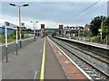
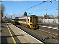
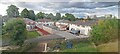

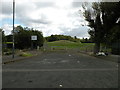
35 photos from this area
Area Information
Key information about the B9 5TY including its size, population, and administrative classification.
- Area Type
- Postcode
- Area Size
- 6897 m²
- Population
- 2325
- Population Density
- 12078 people/km²
House Prices in B9 5TY
26
Properties
£125,765
Average Sold Price
£40,500
Lowest Price
£217,000
Highest Price
Showing 26 properties
| Address | Type | Beds | Baths | Last Sale Price | Last Sale Date | |
|---|---|---|---|---|---|---|
| 184 Norton Crescent, Birmingham, B9 5TY | Terraced | 3 | 1 | £215,000 | Aug 2024 | |
| 152 Norton Crescent, Birmingham, B9 5TY | house | 3 | 1 | £217,000 | Jun 2023 | |
| 154 Norton Crescent, Birmingham, B9 5TY | Semi-detached | 3 | 1 | £188,000 | Apr 2022 | |
| 178 Norton Crescent, Birmingham, B9 5TY | house | - | - | £120,000 | Oct 2017 | |
| 190 Norton Crescent, Birmingham, B9 5TY | house | - | - | £75,000 | Feb 2014 | |
| 176 Norton Crescent, Birmingham, B9 5TY | house | - | - | £93,500 | Mar 2013 | |
| 158 Norton Crescent, Birmingham, B9 5TY | house | 3 | - | £100,000 | Feb 2013 | |
| 168 Norton Crescent, Birmingham, B9 5TY | house | - | - | £109,000 | Jul 2007 | |
| 156 Norton Crescent, Birmingham, B9 5TY | Semi-detached | - | - | £119,000 | Mar 2007 | |
| 182 Norton Crescent, Birmingham, B9 5TY | Terraced | - | - | £124,999 | Sep 2006 |
Page 1 of 3
Energy Efficiency in B9 5TY
Amenities
Schools
| Rank | School | Type | Entry gender | Ages |
|---|
Explore more schools in this area
Go to Schools tabDemographics
Household Size
Family (3-5 people)
most common
Accommodation Type
Houses
most common
Tenure
55
majority
Ethnic Group
asian_total
most common
Religion
N/A
most common
Household Composition
N/A
most common
Age
22
median
Adults (30-64 years)
most common
Household Deprivation
N/A
with no deprivation
NS-SEC
11
in Lower managerial occupations
Explore more demographic insights in this area
Go to Demographics tabPlanning
Planning Constraints
- Flood RiskPremium
- Ramsar Wetland SitesPremium
- Area of Outstanding Natural BeautyPremium
- Protected Nature ReservePremium
- Protected WoodlandPremium