Area Overview for B9 5RX
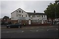
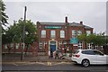
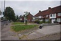
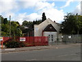
Photos of B9 5RX
Area Information
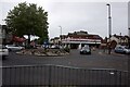
Living in B9 5RX means residing in a densely populated, compact postcode area within Birmingham’s Bordesley Green East district. The area spans just 2.0 hectares, yet accommodates 2,101 residents, resulting in a population density of 106,409 people per square kilometre. This makes it one of the most densely populated areas in England. The postcode is closely tied to Heartlands Hospital, a major NHS facility, and its surrounding infrastructure. Proximity to key transport routes, including the A45 Coventry Road and nearby motorway junctions, ensures easy access to Birmingham’s broader network. Daily life here is shaped by the area’s proximity to healthcare, retail, and public transport. The small size of B9 5RX means residents are likely to share a close-knit environment, though the high density may influence local dynamics. The area’s compact nature also means amenities are within practical reach, from schools to shops and rail links. For those seeking a location with immediate access to essential services and transport, B9 5RX offers a blend of urban convenience and proximity to Birmingham’s core.
- Area Type
- Postcode
- Area Size
- 2.0 hectares
- Population
- 2101
- Population Density
- 6390 people/km²
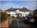
The property market in B9 5RX is defined by a 50% home ownership rate, with houses being the primary accommodation type. This suggests a mix of owner-occupied properties and rental units, though the exact proportion of rentals is not specified. The small area size and high population density imply that properties are likely to be smaller or part of multi-family housing. Given the proximity to Heartlands Hospital and transport links, the area may attract professionals requiring easy access to healthcare and commuting routes. However, the compact nature of the postcode means the housing stock is limited, and buyers should consider the surrounding areas for more options. The 50% ownership rate also indicates a significant rental market, which could affect property values and availability. For buyers, this area is best suited for those prioritising location over space, with properties likely to be practical rather than expansive.
House Prices in B9 5RX
Showing 1 properties
| Address | Type | Beds | Baths | Last Sale Price | Last Sale Date | |
|---|---|---|---|---|---|---|
| Caretakers House, Saltley School, Belchers Lane, Bordesley Green, Birmingham, B9 5RX | education | - | - | - | - |
Energy Efficiency in B9 5RX
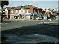
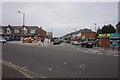
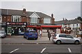
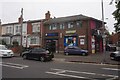
Residents of B9 5RX have access to a range of retail and dining options within practical reach. Notable venues include M&S Birmingham, Aldi Alum, and Lidl Bordesley, providing convenience for everyday shopping. The area’s rail and metro links connect to central Birmingham, expanding access to larger retail hubs, cultural attractions, and dining scenes. While the data does not specify parks or leisure facilities, the proximity to Heartlands Hospital and nearby transport routes suggests opportunities for healthcare services and recreational activities in adjacent areas. The compact nature of the postcode means amenities are closely clustered, reducing travel time for essential services. For daily life, this density offers efficiency, though it may also mean limited private outdoor space. The presence of multiple retail outlets and transport options enhances the area’s practicality, making it suitable for those prioritising convenience over expansive living spaces.
Amenities
Schools
Residents of B9 5RX have access to several primary schools within the vicinity. These include Alston Junior School, Alston Infant School, Saltley School and Specialist Science College, and Alston Primary School. Notably, Alston Primary School has an Ofsted rating of “good,” indicating a school that meets or exceeds national standards in teaching and outcomes. The concentration of primary schools suggests the area is well-served for families with young children, though secondary education options are not listed in the data. The presence of multiple primary schools may reduce travel time for parents, though the specific catchment areas for each school are not detailed. For families, the mix of schools provides choices, though the quality of secondary education would require further investigation. The “good” rating at Alston Primary School is a positive indicator for local education standards.
| Rank | School | Type | Entry gender | Ages |
|---|
Explore more schools in this area
Go to Schools tabDemographics
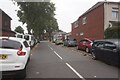
The community in B9 5RX is predominantly composed of adults aged 30–64, with a median age of 22, indicating a mix of working-age residents and younger individuals. Home ownership stands at 50%, suggesting a balance between owner-occupied properties and rental stock. The area’s accommodation is primarily houses, though the high population density implies these are likely smaller or multi-occupancy units. The predominant ethnic group is Asian, reflecting broader demographic trends in Birmingham. This composition shapes the area’s cultural and social landscape, with community interactions likely influenced by shared heritage and local traditions. The high population density, while offering proximity to services, may also contribute to a sense of shared space. For residents, this density means limited private outdoor space but strong access to communal amenities. The data does not indicate deprivation levels, but the combination of high density and limited land area suggests a focus on efficient, compact living.
Household Size
Accommodation Type
Tenure
Ethnic Group
Religion
Household Composition
Age
Household Deprivation
NS-SEC
Explore more demographic insights in this area
Go to Demographics tabPlanning
Planning Constraints
- Flood RiskPremium
- Ramsar Wetland SitesPremium
- Area of Outstanding Natural BeautyPremium
- Protected Nature ReservePremium
- Protected WoodlandPremium