Area Overview for B9 5PN
Photos of B9 5PN
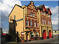
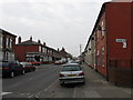
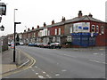
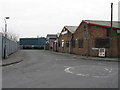
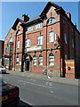
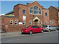
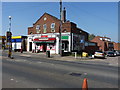
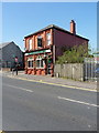
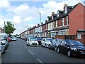
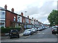
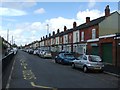
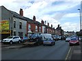
57 photos from this area
Area Information
Key information about the B9 5PN including its size, population, and administrative classification.
- Area Type
- Postcode
- Area Size
- 2104 m²
- Population
- 2419
- Population Density
- 18508 people/km²
House Prices in B9 5PN
10
Properties
£120,000
Average Sold Price
£51,000
Lowest Price
£189,000
Highest Price
Showing 10 properties
| Address | Type | Beds | Baths | Last Sale Price | Last Sale Date | |
|---|---|---|---|---|---|---|
| 321 Green Lane, Bordesley Green, Birmingham, B9 5PN | Terraced | 4 | - | £189,000 | May 2017 | |
| 323 Green Lane, Bordesley Green, Birmingham, B9 5PN | house | - | - | £51,000 | Mar 1997 | |
| 315 Green Lane, Bordesley Green, Birmingham, B9 5PN | Detached | - | - | - | - | |
| Gnd 1ST And 2ND Flrs, 313-315 Green Lane, Bordesley Green, Birmingham, B9 5PN | Flat | - | - | - | - | |
| 291 Green Lane, Bordesley Green, Birmingham, B9 5PN | Retail | - | - | - | - | |
| 293 Green Lane, Bordesley Green, Birmingham, B9 5PN | Retail | - | - | - | - | |
| 317 Green Lane, Bordesley Green, Birmingham, B9 5PN | house | - | - | - | - | |
| 327 Green Lane, Bordesley Green, Birmingham, B9 5PN | house | - | - | - | - | |
| 325 Green Lane, Bordesley Green, Birmingham, B9 5PN | house | - | - | - | - | |
| 319 Green Lane, Bordesley Green, Birmingham, B9 5PN | Terraced | - | - | - | - |
Energy Efficiency in B9 5PN
Amenities
Schools
| Rank | School | Type | Entry gender | Ages |
|---|
Explore more schools in this area
Go to Schools tabDemographics
Household Size
Family (3-5 people)
most common
Accommodation Type
Houses
most common
Tenure
73
majority
Ethnic Group
asian_total
most common
Religion
N/A
most common
Household Composition
N/A
most common
Age
22
median
Adults (30-64 years)
most common
Household Deprivation
N/A
with no deprivation
NS-SEC
11
in Lower managerial occupations
Explore more demographic insights in this area
Go to Demographics tabPlanning
Planning Constraints
- Flood RiskPremium
- Ramsar Wetland SitesPremium
- Area of Outstanding Natural BeautyPremium
- Protected Nature ReservePremium
- Protected WoodlandPremium