Area Overview for B9 5LL
Photos of B9 5LL
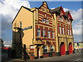
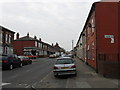
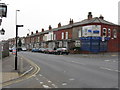
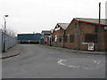
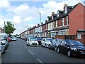
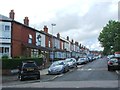
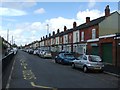
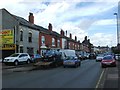
57 photos from this area
Area Information
Key information about the B9 5LL including its size, population, and administrative classification.
- Area Type
- Postcode
- Area Size
- 7589 m²
- Population
- 3407
- Population Density
- 5052 people/km²
House Prices in B9 5LL
41
Properties
£90,276
Average Sold Price
£19,500
Lowest Price
£187,000
Highest Price
Showing 41 properties
| Address | Type | Beds | Baths | Last Sale Price | Last Sale Date | |
|---|---|---|---|---|---|---|
| 143 Pretoria Road, Birmingham, B9 5LL | Terraced | 3 | 1 | £187,000 | Aug 2025 | |
| 87 Pretoria Road, Birmingham, B9 5LL | Terraced | 2 | 1 | £158,000 | Jun 2025 | |
| 103 Pretoria Road, Birmingham, B9 5LL | house | - | - | £27,360 | Jul 2024 | |
| 83 Pretoria Road, Birmingham, B9 5LL | Terraced | 2 | 2 | £115,000 | Oct 2020 | |
| 111 Pretoria Road, Birmingham, B9 5LL | Terraced | 2 | 2 | £80,000 | Jan 2018 | |
| 151 Pretoria Road, Birmingham, B9 5LL | house | - | - | £105,000 | Dec 2016 | |
| 99 Pretoria Road, Birmingham, B9 5LL | Terraced | - | - | £100,000 | Jul 2016 | |
| 115 Pretoria Road, Birmingham, B9 5LL | house | - | - | £104,000 | Feb 2016 | |
| 109 Pretoria Road, Birmingham, B9 5LL | house | - | - | £92,500 | May 2015 | |
| 113 Pretoria Road, Birmingham, B9 5LL | house | 3 | 1 | £87,700 | Mar 2014 |
Page 1 of 5
Energy Efficiency in B9 5LL
Amenities
Schools
| Rank | School | Type | Entry gender | Ages |
|---|
Explore more schools in this area
Go to Schools tabDemographics
Household Size
Family (3-5 people)
most common
Accommodation Type
Houses
most common
Tenure
51
majority
Ethnic Group
asian_total
most common
Religion
N/A
most common
Household Composition
N/A
most common
Age
22
median
Adults (30-64 years)
most common
Household Deprivation
N/A
with no deprivation
NS-SEC
9
in Lower managerial occupations
Explore more demographic insights in this area
Go to Demographics tabPlanning
Planning Constraints
- Flood RiskPremium
- Ramsar Wetland SitesPremium
- Area of Outstanding Natural BeautyPremium
- Protected Nature ReservePremium
- Protected WoodlandPremium