Area Overview for B9 4QH
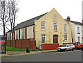
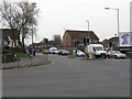
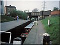
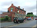
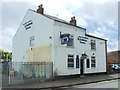
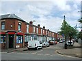
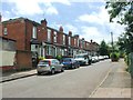
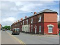
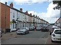
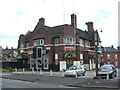
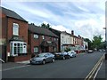
Photos of B9 4QH

Area Information
Living in B9 4QH means inhabiting a tightly packed urban enclave in Birmingham’s heart, where 1,439 residents occupy just 1.4 hectares. This small postcode area, part of the Bordesley and Highgate ward, sits east of the city centre, blending historic roots with modern life. The area’s compact size fosters a dense, interconnected community, with proximity to Birmingham’s cultural and commercial hubs. Its history stretches back to the 7th century, with Bordesley’s name reflecting ancient land-clearing practices. Today, the area thrives as a mix of residential flats and industrial legacy, with schools, retail, and transport links within walking distance. The presence of independent schools and multiple railway stations underscores its appeal to families and commuters. While the population density is extreme—over 100,000 people per square kilometre—the area’s compact nature means daily life is centred around immediate access to amenities, from supermarkets to public transport. For those seeking a dynamic, urban lifestyle with historical depth, B9 4QH offers a distinctive blend of proximity and character.
- Area Type
- Postcode
- Area Size
- 1.4 hectares
- Population
- 1439
- Population Density
- 2415 people/km²
The property market in B9 4QH is defined by its high density and limited space. With 34% home ownership, the area is predominantly a rental market, where flats are the primary accommodation type. This suggests a lack of larger homes or detached properties, which may limit options for buyers seeking owner-occupied housing. The small area size means the housing stock is tightly packed, with little scope for expansion. For buyers, this presents challenges: the market is likely competitive, with limited availability of flats for purchase. However, the proximity to transport links and amenities may offset these constraints, appealing to those prioritising convenience over property size. Investors or first-time buyers should consider the area’s rental potential, though the high population density and flat-dominated stock may mean long-term value depends on local demand and infrastructure developments.
House Prices in B9 4QH
Showing 41 properties
| Address | Type | Beds | Baths | Last Sale Price | Last Sale Date | |
|---|---|---|---|---|---|---|
| 23 Artillery Street, Birmingham, B9 4QH | Retail | 2 | 1 | £84,000 | Nov 2001 | |
| 25 Artillery Street, Birmingham, B9 4QH | house | - | - | £84,000 | Oct 2001 | |
| 27 Artillery Street, Birmingham, B9 4QH | house | - | - | £117,500 | May 2001 | |
| 29 Artillery Street, Birmingham, B9 4QH | Semi-detached | 6 | 3 | £95,000 | Dec 1998 | |
| 21 Artillery Street, Birmingham, B9 4QH | Terraced | 2 | 1 | £51,100 | Oct 1998 | |
| Flat 6, 24 Artillery Street, Birmingham, B9 4QH | Flat | 2 | 1 | - | - | |
| Flat 6, 22 Artillery Street, Birmingham, B9 4QH | Flat | 2 | 1 | - | - | |
| Flat 12, 24 Artillery Street, Birmingham, B9 4QH | Flat | 1 | 1 | - | - | |
| Flat 1, 22 Artillery Street, Birmingham, B9 4QH | Flat | 1 | 1 | - | - | |
| Flat 4, 20 Artillery Street, Birmingham, B9 4QH | Flat | - | - | - | - |
Energy Efficiency in B9 4QH
Residents of B9 4QH enjoy a range of nearby amenities, from retail to transport. The area’s retail options include Iceland Birmingham, Morrisons Bordesley, and Co-op Birmingham, providing essential shopping within walking distance. For dining and leisure, the proximity to Birmingham’s city centre opens up broader options, though the immediate vicinity focuses on practical needs. The density of the area means amenities are tightly clustered, reducing travel time for daily tasks. The presence of multiple railway and metro stations enhances mobility, allowing quick access to cultural, commercial, and recreational spaces beyond the postcode. While the area itself is small, its integration with Birmingham’s transport network ensures residents can easily explore the city’s wider offerings. The compact nature of B9 4QH fosters convenience, though it may lack expansive green spaces or large-scale leisure facilities.
Amenities
Schools
Residents of B9 4QH have access to two independent schools: Academy Al-Ansaar and Avecinna Academy. Both are private institutions, offering alternative education options for families seeking non-state-run schooling. The presence of independent schools suggests the area attracts households prioritising specific educational environments. However, the absence of state schools in the data means the local education landscape may be skewed towards private institutions. For families reliant on state education, proximity to other wards or Birmingham’s broader school network would be crucial. The two independent schools provide a choice for those willing to pay for private education, but the lack of detailed Ofsted ratings or academic performance data leaves room for further inquiry into their quality.
| Rank | School | Type | Entry gender | Ages |
|---|
Explore more schools in this area
Go to Schools tabDemographics
B9 4QH’s population of 1,439 is young, with a median age of 22, though the most common age range is 30–64 years. This suggests a mix of young professionals and families. Only 34% of residents own their homes, indicating a predominantly rental market. The area’s accommodation is almost entirely flats, reflecting its high-density layout. The predominant ethnic group is Asian, a detail that shapes the community’s cultural fabric. While specific deprivation data is not provided, the high proportion of renters and young residents may point to a transient demographic. The area’s compact size means social interactions are frequent, with shared spaces and communal living shaping daily life. The presence of independent schools and retail hubs suggests a focus on family-centric amenities, though the lack of data on deprivation leaves some quality-of-life factors unexplored.
Household Size
Accommodation Type
Tenure
Ethnic Group
Religion
Household Composition
Age
Household Deprivation
NS-SEC
Explore more demographic insights in this area
Go to Demographics tabPlanning
Planning Constraints
- Flood RiskPremium
- Ramsar Wetland SitesPremium
- Area of Outstanding Natural BeautyPremium
- Protected Nature ReservePremium
- Protected WoodlandPremium