Area Overview for B9 4NZ
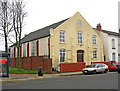
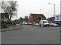
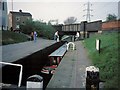
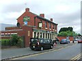
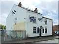
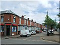
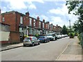
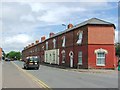
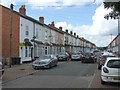
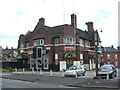
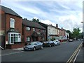
Photos of B9 4NZ

Area Information
B9 4NZ is a small, densely populated postcode area in Birmingham’s city centre, covering just 4.4 hectares and home to 1,439 residents. Its compact size means it’s a tightly knit part of the Bordesley and Highgate ward, which includes historic districts like Digbeth and Deritend. This area is steeped in industrial heritage, with roots tracing back to the 7th century, and today it sits at the crossroads of Birmingham’s past and present. Daily life here is shaped by proximity to the city’s core, with easy access to rail and metro networks. The area’s demographics reflect a blend of young and middle-aged adults, with 34% owning their homes and the rest likely renting flats, which dominate the housing stock. While the population density is extremely high at 33,075 people per square kilometre, the area’s charm lies in its mix of urban convenience and historical character, from 19th-century industrial sites to modern retail hubs. For those seeking a central location with a compact footprint, B9 4NZ offers proximity to Birmingham’s cultural and economic heart, though its small size means every decision about living here is tightly bound to its immediate surroundings.
- Area Type
- Postcode
- Area Size
- 4.4 hectares
- Population
- 1439
- Population Density
- 2415 people/km²
The property market in B9 4NZ is dominated by rental flats, with only 34% of homes owned by residents. This suggests a strong rental market, likely driven by the area’s compact size and proximity to Birmingham’s city centre. The prevalence of flats indicates limited availability of larger, detached properties, which may appeal more to younger professionals or those prioritising convenience over space. Given the area’s small footprint, the housing stock is likely constrained, meaning competition for available properties could be fierce. For buyers, this presents a challenge: the limited number of owner-occupied homes may mean fewer opportunities for purchase, and those interested in buying would need to consider the potential for long-term rental yields. The high population density also implies that property values may be influenced more by location and transport links than by size or land area. Those considering the area should weigh the benefits of central connectivity against the limitations of a flat-dominated market.
House Prices in B9 4NZ
Showing 5 properties
| Address | Type | Beds | Baths | Last Sale Price | Last Sale Date | |
|---|---|---|---|---|---|---|
| Unit 27, Century Park, Garrison Lane, Birmingham, B9 4NZ | warehouse | - | - | - | - | |
| Unit 19, Century Park, Garrison Lane, Birmingham, B9 4NZ | Industrial | - | - | - | - | |
| Unit 28, Century Park, Garrison Lane, Birmingham, B9 4NZ | Industrial | - | - | - | - | |
| Unit 12B, Century Park, Garrison Lane, Birmingham, B9 4NZ | Office | - | - | - | - | |
| Unit 12A, Century Park, Garrison Lane, Birmingham, B9 4NZ | Industrial | - | - | - | - |
Energy Efficiency in B9 4NZ
Living in B9 4NZ offers a blend of urban convenience and proximity to essential amenities. The area’s retail options include major supermarkets such as Morrisons Bordesley, Iceland Birmingham, and Asda Bordersley, providing easy access to groceries and everyday essentials. For transport, residents are served by five rail stations and three metro stops, ensuring swift connections to Birmingham’s wider network. While the data does not mention parks or leisure facilities directly, the area’s historical industrial character suggests a focus on commercial and residential functions rather than green spaces. The compact nature of B9 4NZ means that daily life revolves around its immediate surroundings, with a strong emphasis on accessibility to city-centre services. For those who prioritise proximity to retail and transport, this area offers a practical lifestyle, though those seeking expansive recreational areas may need to look further afield.
Amenities
Schools
Residents of B9 4NZ have access to two independent schools: Academy Al-Ansaar and Avecinna Academy. Both are private institutions, which may appeal to families seeking alternative education options outside the state system. Independent schools often offer smaller class sizes, specialised curricula, and additional extracurricular opportunities, though they typically require higher fees. The presence of these schools suggests that the area attracts families prioritising educational choice, though no data on Ofsted ratings or academic performance is provided. For those considering B9 4NZ, the availability of independent schools could be a key factor, particularly for households seeking non-state education. However, the absence of state schools in the data means it’s unclear whether the area’s schools cater to a broad demographic or serve a specific niche. Prospective buyers should investigate further to assess the quality and accessibility of these institutions.
| Rank | School | Type | Entry gender | Ages |
|---|
Explore more schools in this area
Go to Schools tabDemographics
The population of B9 4NZ skews young, with a median age of 22, though the most common age range is 30-64 years. This suggests a mix of younger professionals and older families, though the exact balance is unclear. Home ownership is low at 34%, indicating that the majority of residents are likely renting, which is typical for urban areas with high population density. The accommodation type is predominantly flats, reflecting the area’s compact nature and likely influence of high-rise developments. The predominant ethnic group is listed as Asian_total, though no further breakdown is provided. This demographic profile shapes the community’s character, with a focus on shared spaces and proximity to services. The high population density of 33,075 people per square kilometre means residents are closely packed, which can influence social dynamics and the availability of private outdoor space. For buyers, this suggests a market where rental demand may outpace ownership, and where community interactions are frequent but potentially intense.
Household Size
Accommodation Type
Tenure
Ethnic Group
Religion
Household Composition
Age
Household Deprivation
NS-SEC
Explore more demographic insights in this area
Go to Demographics tabPlanning
Planning Constraints
- Flood RiskPremium
- Ramsar Wetland SitesPremium
- Area of Outstanding Natural BeautyPremium
- Protected Nature ReservePremium
- Protected WoodlandPremium