Area Overview for B9 4BS
Photos of B9 4BS
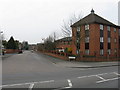
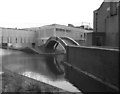
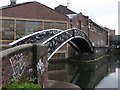
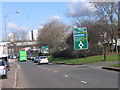
100 photos from this area
Area Information
Key information about the B9 4BS including its size, population, and administrative classification.
- Area Type
- Postcode
- Area Size
- 1.5 hectares
- Population
- 1439
- Population Density
- 2415 people/km²
House Prices in B9 4BS
10
Properties
-
Average Sold Price
-
Lowest Price
-
Highest Price
Showing 10 properties
| Address | Type | Beds | Baths | Last Sale Price | Last Sale Date | |
|---|---|---|---|---|---|---|
| First Floor And Second Floor, 108 Garrison Lane, Birmingham, B9 4BS | Retail | - | - | - | - | |
| The Garrison Public House, Garrison Lane, Birmingham, B9 4BS | Leisure | - | - | - | - | |
| Car Sales, 42 Garrison Lane, Birmingham, B9 4BS | commercial | - | - | - | - | |
| Flat Rear Of, The Garrison Public House, Garrison Lane, Birmingham, B9 4BS | Flat | - | - | - | - | |
| Unit G1, The Garrison Centre, Garrison Lane, Birmingham, B9 4BS | shop | - | - | - | - | |
| Unit G8, The Garrison Centre, Garrison Lane, Birmingham, B9 4BS | shop | - | - | - | - | |
| Unit 9B, The Garrison Centre, Garrison Lane, Birmingham, B9 4BS | shop | - | - | - | - | |
| Fivestar Hand Carwash, 42 Garrison Lane, Birmingham, B9 4BS | office_workshop | - | - | - | - | |
| 46-52 Garrison Lane, Birmingham, B9 4BS | commercial | - | - | - | - | |
| Flat 1, The Garrison Public House, 110 Garrison Lane, Birmingham, B9 4BS | restaurant_cafe | - | - | - | - |
Energy Efficiency in B9 4BS
Amenities
Schools
| Rank | School | Type | Entry gender | Ages |
|---|
Explore more schools in this area
Go to Schools tabDemographics
Household Size
Family (3-5 people)
most common
Accommodation Type
Flats
most common
Tenure
34
majority
Ethnic Group
asian_total
most common
Religion
N/A
most common
Household Composition
N/A
most common
Age
22
median
Adults (30-64 years)
most common
Household Deprivation
N/A
with no deprivation
NS-SEC
23
in Lower managerial occupations
Explore more demographic insights in this area
Go to Demographics tabPlanning
Planning Constraints
- Flood RiskPremium
- Ramsar Wetland SitesPremium
- Area of Outstanding Natural BeautyPremium
- Protected Nature ReservePremium
- Protected WoodlandPremium