Area Overview for B80 7RS
Photos of B80 7RS
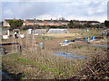
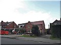
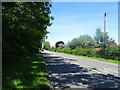
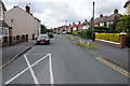
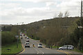
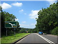
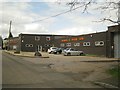
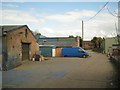
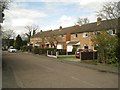
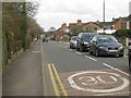

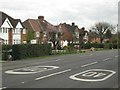
17 photos from this area
Area Information
Key information about the B80 7RS including its size, population, and administrative classification.
- Area Type
- Postcode
- Area Size
- 6166 m²
- Population
- 1485
- Population Density
- 2707 people/km²
House Prices in B80 7RS
16
Properties
£187,433
Average Sold Price
£59,500
Lowest Price
£333,000
Highest Price
Showing 16 properties
| Address | Type | Beds | Baths | Last Sale Price | Last Sale Date | |
|---|---|---|---|---|---|---|
| 12 Badbury Close, Studley, B80 7RS | Semi-detached | 3 | 1 | £315,000 | Mar 2025 | |
| 14 Badbury Close, Studley, B80 7RS | Semi-detached | 3 | 1 | £325,000 | Jun 2024 | |
| 10 Badbury Close, Studley, B80 7RS | Semi-detached | 3 | 1 | £303,000 | Aug 2023 | |
| 30 Badbury Close, Studley, B80 7RS | Semi-detached | 2 | 1 | £333,000 | Oct 2022 | |
| 32 Badbury Close, Studley, B80 7RS | Bungalow | 3 | 2 | £162,500 | Jun 2019 | |
| 8 Badbury Close, Studley, B80 7RS | Semi-detached | 3 | 1 | £250,000 | Jul 2018 | |
| 28 Badbury Close, Studley, B80 7RS | Semi-detached | 3 | 1 | £147,000 | Mar 2014 | |
| 6 Badbury Close, Studley, B80 7RS | Semi-detached | 3 | - | £164,000 | Jul 2012 | |
| 20 Badbury Close, Studley, B80 7RS | house | 3 | - | £158,000 | Aug 2011 | |
| 22 Badbury Close, Studley, B80 7RS | house | - | - | £176,500 | Nov 2006 |
Page 1 of 2
Energy Efficiency in B80 7RS
Amenities
Schools
| Rank | School | Type | Entry gender | Ages |
|---|
Explore more schools in this area
Go to Schools tabDemographics
Household Size
Two person
most common
Accommodation Type
Houses
most common
Tenure
83
majority
Ethnic Group
White
most common
Religion
N/A
most common
Household Composition
N/A
most common
Age
47
median
Adults (30-64 years)
most common
Household Deprivation
N/A
with no deprivation
NS-SEC
35
in Lower managerial occupations
Explore more demographic insights in this area
Go to Demographics tabPlanning
Planning Constraints
- Flood RiskPremium
- Ramsar Wetland SitesPremium
- Area of Outstanding Natural BeautyPremium
- Protected Nature ReservePremium
- Protected WoodlandPremium