Area Overview for B80 7RE
Photos of B80 7RE
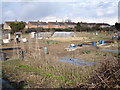
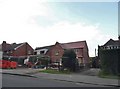
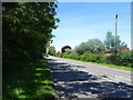
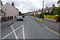
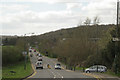
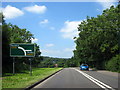

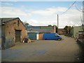
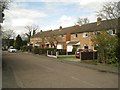

17 photos from this area
Area Information
Key information about the B80 7RE including its size, population, and administrative classification.
- Area Type
- Postcode
- Area Size
- 1.3 hectares
- Population
- 1485
- Population Density
- 2707 people/km²
House Prices in B80 7RE
28
Properties
£183,783
Average Sold Price
£55,000
Lowest Price
£325,000
Highest Price
Showing 28 properties
| Address | Type | Beds | Baths | Last Sale Price | Last Sale Date | |
|---|---|---|---|---|---|---|
| 3 Warwick Close, Studley, B80 7RE | Semi-detached | 2 | 1 | £237,500 | Mar 2025 | |
| 26A Warwick Close, Studley, B80 7RE | Bungalow | 2 | 1 | £325,000 | Mar 2025 | |
| 11 Warwick Close, Studley, B80 7RE | Semi-detached | 2 | 1 | £230,000 | Aug 2023 | |
| 14 Warwick Close, Studley, B80 7RE | Semi-detached | 4 | 1 | £245,000 | Aug 2019 | |
| 6 Warwick Close, Studley, B80 7RE | house | 3 | - | £195,000 | Jan 2017 | |
| 28 Warwick Close, Studley, B80 7RE | Detached | 4 | 2 | £230,000 | Mar 2016 | |
| Yewcroft, Warwick Close, Studley, B80 7RE | Detached | 4 | - | £248,000 | Mar 2015 | |
| 24B Warwick Close, Studley, B80 7RE | Bungalow | - | - | £248,000 | Dec 2011 | |
| 20 Warwick Close, Studley, B80 7RE | Bungalow | - | - | £165,000 | Jul 2011 | |
| The Firs, 30 Warwick Close, Studley, B80 7RE | Semi-detached | 3 | 1 | £75,000 | Jun 2011 |
Page 1 of 3
Energy Efficiency in B80 7RE
Amenities
Schools
| Rank | School | Type | Entry gender | Ages |
|---|
Explore more schools in this area
Go to Schools tabDemographics
Household Size
Two person
most common
Accommodation Type
Houses
most common
Tenure
83
majority
Ethnic Group
White
most common
Religion
N/A
most common
Household Composition
N/A
most common
Age
47
median
Adults (30-64 years)
most common
Household Deprivation
N/A
with no deprivation
NS-SEC
35
in Lower managerial occupations
Explore more demographic insights in this area
Go to Demographics tabPlanning
Planning Constraints
- Flood RiskPremium
- Ramsar Wetland SitesPremium
- Area of Outstanding Natural BeautyPremium
- Protected Nature ReservePremium
- Protected WoodlandPremium