Area Overview for B80 7NT
Photos of B80 7NT
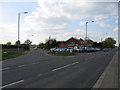

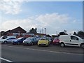

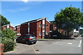
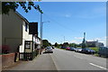
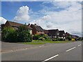
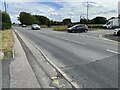
31 photos from this area
Area Information
Key information about the B80 7NT including its size, population, and administrative classification.
- Area Type
- Postcode
- Area Size
- 9047 m²
- Population
- 1528
- Population Density
- 1487 people/km²
House Prices in B80 7NT
21
Properties
£184,897
Average Sold Price
£43,000
Lowest Price
£397,500
Highest Price
Showing 21 properties
| Address | Type | Beds | Baths | Last Sale Price | Last Sale Date | |
|---|---|---|---|---|---|---|
| 130 Alcester Road, Studley, B80 7NT | Terraced | 2 | 1 | £208,000 | Dec 2022 | |
| 128 Alcester Road, Studley, B80 7NT | Retail | 2 | 1 | £215,000 | Nov 2022 | |
| 134 Alcester Road, Studley, B80 7NT | Terraced | 2 | 1 | £231,500 | Dec 2021 | |
| 126 Alcester Road, Studley, B80 7NT | Terraced | 2 | 1 | £175,500 | Sep 2020 | |
| 124 Alcester Road, Studley, B80 7NT | Terraced | 2 | - | £172,000 | Jan 2018 | |
| 160 Alcester Road, Studley, B80 7NT | Detached | 4 | 3 | £375,000 | Jun 2013 | |
| 122 Alcester Road, Studley, B80 7NT | house | - | - | £115,000 | Nov 2009 | |
| 132 Alcester Road, Studley, B80 7NT | Terraced | 3 | - | £165,000 | Jul 2007 | |
| 118 Alcester Road, Studley, B80 7NT | Detached | 4 | 2 | £397,500 | Oct 2005 | |
| 142 Alcester Road, Studley, B80 7NT | Flat | - | - | £115,000 | Sep 2004 |
Page 1 of 3
Energy Efficiency in B80 7NT
Amenities
Schools
| Rank | School | Type | Entry gender | Ages |
|---|
Explore more schools in this area
Go to Schools tabDemographics
Household Size
Two person
most common
Accommodation Type
Houses
most common
Tenure
66
majority
Ethnic Group
White
most common
Religion
N/A
most common
Household Composition
N/A
most common
Age
47
median
Adults (30-64 years)
most common
Household Deprivation
N/A
with no deprivation
NS-SEC
31
in Lower managerial occupations
Explore more demographic insights in this area
Go to Demographics tabPlanning
Planning Constraints
- Flood RiskPremium
- Ramsar Wetland SitesPremium
- Area of Outstanding Natural BeautyPremium
- Protected Nature ReservePremium
- Protected WoodlandPremium