Area Overview for B80 7JE
Photos of B80 7JE
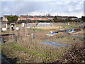
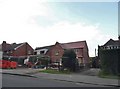
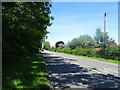
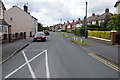
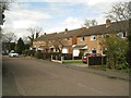
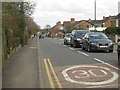

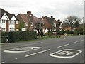
17 photos from this area
Area Information
Key information about the B80 7JE including its size, population, and administrative classification.
- Area Type
- Postcode
- Area Size
- 1.2 hectares
- Population
- Not available
- Population Density
- Not available
House Prices in B80 7JE
20
Properties
£176,445
Average Sold Price
£50,000
Lowest Price
£380,000
Highest Price
Showing 20 properties
| Address | Type | Beds | Baths | Last Sale Price | Last Sale Date | |
|---|---|---|---|---|---|---|
| 168 St Judes Avenue, Studley, B80 7JE | Detached | 4 | 2 | £380,000 | Dec 2021 | |
| 138 St Judes Avenue, Studley, B80 7JE | house | - | - | £245,000 | Sep 2020 | |
| 162 St Judes Avenue, Studley, B80 7JE | Terraced | 3 | 2 | £257,000 | Sep 2019 | |
| 152 St Judes Avenue, Studley, B80 7JE | house | - | - | £205,000 | Jun 2019 | |
| 158 St Judes Avenue, Studley, B80 7JE | Terraced | 3 | - | £158,000 | Dec 2013 | |
| 132 St Judes Avenue, Studley, B80 7JE | house | 3 | - | £169,950 | Mar 2012 | |
| 77 St Judes Avenue, Studley, B80 7JE | house | - | - | £169,000 | Mar 2011 | |
| 148 St Judes Avenue, Studley, B80 7JE | house | - | - | £165,000 | Jul 2009 | |
| 136 St Judes Avenue, Studley, B80 7JE | Semi-detached | - | - | £203,500 | Feb 2007 | |
| 146 St Judes Avenue, Studley, B80 7JE | Terraced | - | - | £157,000 | Aug 2005 |
Page 1 of 2
Energy Efficiency in B80 7JE
Amenities
Schools
| Rank | School | Type | Entry gender | Ages |
|---|
Explore more schools in this area
Go to Schools tabDemographics
Household Size
One person
most common
Accommodation Type
Houses
most common
Tenure
65
majority
Ethnic Group
White
most common
Religion
N/A
most common
Household Composition
N/A
most common
Age
47
median
Adults (30-64 years)
most common
Household Deprivation
N/A
with no deprivation
NS-SEC
28
in Lower managerial occupations
Explore more demographic insights in this area
Go to Demographics tabPlanning
Planning Constraints
- Flood RiskPremium
- Ramsar Wetland SitesPremium
- Area of Outstanding Natural BeautyPremium
- Protected Nature ReservePremium
- Protected WoodlandPremium