Area Overview for B80 7JA
Photos of B80 7JA
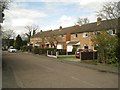
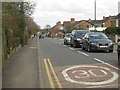

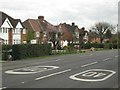
17 photos from this area
Area Information
Key information about the B80 7JA including its size, population, and administrative classification.
- Area Type
- Postcode
- Area Size
- 1.5 hectares
- Population
- Not available
- Population Density
- Not available
House Prices in B80 7JA
41
Properties
£194,175
Average Sold Price
£56,250
Lowest Price
£320,000
Highest Price
Showing 41 properties
| Address | Type | Beds | Baths | Last Sale Price | Last Sale Date | |
|---|---|---|---|---|---|---|
| 17 St Judes Avenue, Studley, B80 7JA | Semi-detached | 3 | 1 | £285,000 | Nov 2024 | |
| 14 St Judes Avenue, Studley, B80 7JA | Semi-detached | 3 | 1 | £252,000 | Jun 2024 | |
| 20 St Judes Avenue, Studley, B80 7JA | Semi-detached | 3 | 1 | £240,000 | May 2024 | |
| 19 St Judes Avenue, Studley, B80 7JA | Semi-detached | 3 | 1 | £250,000 | May 2024 | |
| 7 St Judes Avenue, Studley, B80 7JA | house | - | - | £290,000 | Aug 2022 | |
| 32 St Judes Avenue, Studley, B80 7JA | Bungalow | - | - | £260,000 | Jan 2022 | |
| 24 St Judes Avenue, Studley, B80 7JA | Detached | 3 | 1 | £260,000 | Sep 2021 | |
| 11 St Judes Avenue, Studley, B80 7JA | house | - | - | £320,000 | Mar 2021 | |
| 13 St Judes Avenue, Studley, B80 7JA | house | - | - | £268,000 | Oct 2017 | |
| 38 St Judes Avenue, Studley, B80 7JA | Bungalow | 2 | 1 | £210,000 | May 2017 |
Page 1 of 5
Energy Efficiency in B80 7JA
Amenities
Schools
| Rank | School | Type | Entry gender | Ages |
|---|
Explore more schools in this area
Go to Schools tabDemographics
Household Size
One person
most common
Accommodation Type
Houses
most common
Tenure
65
majority
Ethnic Group
White
most common
Religion
N/A
most common
Household Composition
N/A
most common
Age
47
median
Adults (30-64 years)
most common
Household Deprivation
N/A
with no deprivation
NS-SEC
28
in Lower managerial occupations
Explore more demographic insights in this area
Go to Demographics tabPlanning
Planning Constraints
- Flood RiskPremium
- Ramsar Wetland SitesPremium
- Area of Outstanding Natural BeautyPremium
- Protected Nature ReservePremium
- Protected WoodlandPremium