Area Overview for B80 7EF
Photos of B80 7EF
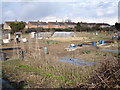
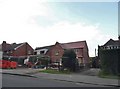
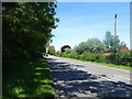
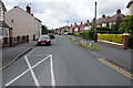
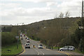
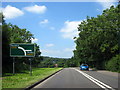

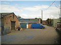
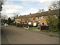

17 photos from this area
Area Information
Key information about the B80 7EF including its size, population, and administrative classification.
- Area Type
- Postcode
- Area Size
- 1.5 hectares
- Population
- 1961
- Population Density
- 53 people/km²
House Prices in B80 7EF
20
Properties
£261,492
Average Sold Price
£97,500
Lowest Price
£500,000
Highest Price
Showing 20 properties
| Address | Type | Beds | Baths | Last Sale Price | Last Sale Date | |
|---|---|---|---|---|---|---|
| 4 Kiln Close, Studley, B80 7EF | Detached | 3 | 2 | £320,000 | Jun 2025 | |
| 2 Kiln Close, Studley, B80 7EF | Detached | 4 | 2 | £445,000 | May 2023 | |
| 19 Kiln Close, Studley, B80 7EF | Detached | 5 | 3 | £500,000 | Dec 2022 | |
| 17 Kiln Close, Studley, B80 7EF | Land | - | - | £427,000 | Oct 2022 | |
| 20 Kiln Close, Studley, B80 7EF | house | - | - | £332,000 | Sep 2017 | |
| 9 Kiln Close, Studley, B80 7EF | Detached | 5 | - | £350,000 | Jul 2015 | |
| 7 Kiln Close, Studley, B80 7EF | house | 4 | - | £265,000 | May 2012 | |
| 16 Kiln Close, Studley, B80 7EF | house | 4 | 2 | £249,000 | May 2012 | |
| 8 Kiln Close, Studley, B80 7EF | Detached | - | - | £250,000 | Aug 2011 | |
| 18 Kiln Close, Studley, B80 7EF | house | 4 | - | £242,500 | Apr 2011 |
Page 1 of 2
Energy Efficiency in B80 7EF
Amenities
Schools
| Rank | School | Type | Entry gender | Ages |
|---|
Explore more schools in this area
Go to Schools tabDemographics
Household Size
Two person
most common
Accommodation Type
Houses
most common
Tenure
80
majority
Ethnic Group
White
most common
Religion
N/A
most common
Household Composition
N/A
most common
Age
47
median
Adults (30-64 years)
most common
Household Deprivation
N/A
with no deprivation
NS-SEC
46
in Lower managerial occupations
Explore more demographic insights in this area
Go to Demographics tabPlanning
Planning Constraints
- Flood RiskPremium
- Ramsar Wetland SitesPremium
- Area of Outstanding Natural BeautyPremium
- Protected Nature ReservePremium
- Protected WoodlandPremium