Area Overview for B80 7BX
Photos of B80 7BX

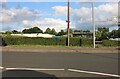
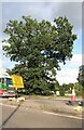
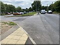
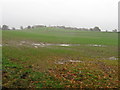

19 photos from this area
Area Information
Key information about the B80 7BX including its size, population, and administrative classification.
- Area Type
- Postcode
- Area Size
- 11.4 hectares
- Population
- 1961
- Population Density
- 53 people/km²
House Prices in B80 7BX
18
Properties
£483,964
Average Sold Price
£215,000
Lowest Price
£715,000
Highest Price
Showing 18 properties
| Address | Type | Beds | Baths | Last Sale Price | Last Sale Date | |
|---|---|---|---|---|---|---|
| Tara, Haye Lane, Mappleborough Green, B80 7BX | Detached | 4 | 2 | £715,000 | Jan 2024 | |
| The Granary, Haye Lane, Mappleborough Green, B80 7BX | Semi-detached | 3 | 3 | £630,000 | Jun 2023 | |
| Gleanings, Haye Lane, Mappleborough Green, B80 7BX | Bungalow | - | - | £490,000 | Feb 2023 | |
| Greenwood, Haye Lane, Mappleborough Green, B80 7BX | Bungalow | 2 | 2 | £410,000 | Jun 2020 | |
| Waterside, Haye Lane, Mappleborough Green, B80 7BX | Semi-detached | 3 | 2 | £645,000 | Dec 2018 | |
| Greenhayes, Haye Lane, Mappleborough Green, B80 7BX | Bungalow | 3 | - | £330,000 | Sep 2017 | |
| Highfield House, Haye Lane, Mappleborough Green, B80 7BX | Detached | 4 | 2 | £550,000 | Mar 2016 | |
| Edgewood, Haye Lane, Mappleborough Green, B80 7BX | Bungalow | - | - | £465,000 | Dec 2015 | |
| Rysdon House, Haye Lane, Mappleborough Green, B80 7BX | house | 5 | - | £484,000 | May 2012 | |
| Lawnswood, Haye Lane, Mappleborough Green, B80 7BX | house | - | - | £600,000 | Mar 2011 |
Page 1 of 2
Energy Efficiency in B80 7BX
Amenities
Schools
| Rank | School | Type | Entry gender | Ages |
|---|
Explore more schools in this area
Go to Schools tabDemographics
Household Size
Two person
most common
Accommodation Type
Houses
most common
Tenure
80
majority
Ethnic Group
White
most common
Religion
N/A
most common
Household Composition
N/A
most common
Age
47
median
Adults (30-64 years)
most common
Household Deprivation
N/A
with no deprivation
NS-SEC
46
in Lower managerial occupations
Explore more demographic insights in this area
Go to Demographics tabPlanning
Planning Constraints
- Flood RiskPremium
- Ramsar Wetland SitesPremium
- Area of Outstanding Natural BeautyPremium
- Protected Nature ReservePremium
- Protected WoodlandPremium