Area Overview for B8 3RL
Photos of B8 3RL

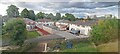
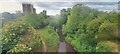
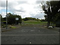
35 photos from this area
Area Information
Key information about the B8 3RL including its size, population, and administrative classification.
- Area Type
- Postcode
- Area Size
- 7376 m²
- Population
- 1883
- Population Density
- 5405 people/km²
House Prices in B8 3RL
11
Properties
£115,000
Average Sold Price
£29,000
Lowest Price
£180,000
Highest Price
Showing 11 properties
| Address | Type | Beds | Baths | Last Sale Price | Last Sale Date | |
|---|---|---|---|---|---|---|
| 26 Eastfield Road, Birmingham, B8 3RL | Semi-detached | 3 | 1 | £180,000 | Aug 2024 | |
| 40 Eastfield Road, Birmingham, B8 3RL | Semi-detached | 3 | 1 | £172,000 | Jul 2017 | |
| 24 Eastfield Road, Birmingham, B8 3RL | house | - | - | £170,000 | Aug 2009 | |
| 42 Eastfield Road, Birmingham, B8 3RL | house | - | - | £122,500 | Jul 2006 | |
| 44 Eastfield Road, Birmingham, B8 3RL | house | - | - | £122,500 | Jul 2006 | |
| 28 Eastfield Road, Birmingham, B8 3RL | Semi-detached | 3 | - | £110,000 | Jun 2006 | |
| 36 Eastfield Road, Birmingham, B8 3RL | house | - | - | £104,000 | Feb 2006 | |
| 38 Eastfield Road, Birmingham, B8 3RL | Detached | 3 | 1 | £96,000 | Mar 2004 | |
| 30 Eastfield Road, Birmingham, B8 3RL | Semi-detached | - | - | £44,000 | Jun 2000 | |
| 34 Eastfield Road, Birmingham, B8 3RL | house | - | - | £29,000 | Jul 1999 |
Page 1 of 2
Energy Efficiency in B8 3RL
Amenities
Schools
| Rank | School | Type | Entry gender | Ages |
|---|
Explore more schools in this area
Go to Schools tabDemographics
Household Size
Family (3-5 people)
most common
Accommodation Type
Houses
most common
Tenure
53
majority
Ethnic Group
asian_total
most common
Religion
N/A
most common
Household Composition
N/A
most common
Age
22
median
Adults (30-64 years)
most common
Household Deprivation
N/A
with no deprivation
NS-SEC
11
in Lower managerial occupations
Explore more demographic insights in this area
Go to Demographics tabPlanning
Planning Constraints
- Flood RiskPremium
- Ramsar Wetland SitesPremium
- Area of Outstanding Natural BeautyPremium
- Protected Nature ReservePremium
- Protected WoodlandPremium