Area Overview for B8 3DJ
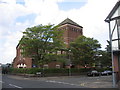
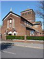
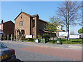
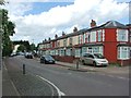
Photos of B8 3DJ
Area Information
Living in B8 3DJ, a small residential postcode cluster in Birmingham’s Alum Rock area, means being part of a densely populated urban community with a distinct character. The area’s population of 1,528 sits within the broader Alum Rock ward, which has a total population of 25,487. Historically named for its alum-rich rock used in leather tanning, the area now centres on Alum Rock Road, a key thoroughfare linking to nearby districts like Stechford and Ward End. Daily life here is shaped by its proximity to Birmingham’s city centre, just 2 miles away, and its mix of local amenities. The area’s younger demographic, with a median age of 22, contrasts with the most common age group of 30-64-year-olds, suggesting a blend of younger residents and families. While the area is diverse, with 93.6% of residents from Black, Asian, and minority ethnic backgrounds, it also faces challenges, including higher deprivation rates and limited employment opportunities. This makes B8 3DJ a place of contrasts: a tight-knit community with access to urban infrastructure, but one that demands careful consideration of long-term prospects.
- Area Type
- Postcode
- Area Size
- Not available
- Population
- 1528
- Population Density
- 6883 people/km²
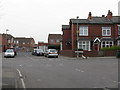
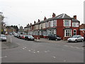
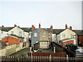
The property market in B8 3DJ is characterised by a relatively low home ownership rate of 36%, suggesting that the area is more rental-oriented than owner-occupied. This aligns with the broader Alum Rock ward’s profile, which has high deprivation and limited employment opportunities. The accommodation type is predominantly houses, which is uncommon for an inner-city postcode, indicating a mix of older, possibly larger properties and newer developments. For buyers, this means the housing stock is not dominated by high-rise flats or apartments, but rather a blend of single-family homes and terraced houses. However, the low home ownership rate and the area’s economic challenges may make it a less attractive option for long-term investment. Prospective buyers should consider the local job market and the potential for property value growth, which may be limited by the area’s socio-economic profile.
House Prices in B8 3DJ
No properties found in this postcode.
Energy Efficiency in B8 3DJ
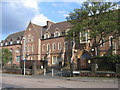
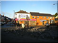
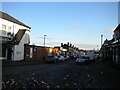
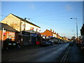
Residents of B8 3DJ have access to a range of amenities within practical reach, including retail outlets like Lidl Bordesley, Asda Bordesley, and Costco Birmingham. These shops provide everyday convenience, though the selection is more focused on essentials than luxury. The area’s transport links to Bull Street, Corporation Street, and St Chads metro stops, as well as nearby railway stations, make it easy to access Birmingham’s commercial and cultural hubs. While the data does not mention parks or leisure facilities, the proximity to Alum Rock Road—a 3km shopping area known locally as “The Rock”—suggests a vibrant retail environment. The presence of the Brookhill Tavern, a Grade II listed pub, adds a touch of local character. However, the area’s inner-city location means recreational spaces may be limited compared to suburban areas. Overall, daily life in B8 3DJ balances accessibility with the constraints of urban density.
Amenities
Schools
Residents of B8 3DJ have access to a range of schools, including both state and independent options. Parkfield Community School, an academy with an Ofsted rating of “outstanding,” provides secondary education, while The Rosary Catholic Primary School, a primary school with a “good” rating, serves younger children. Sanctuary Education, an independent school, offers an alternative to state education. The presence of both academy and independent schools suggests a diverse educational landscape, though the lack of higher-rated institutions may be a concern for families prioritising top-tier schools. The Rosary Catholic Primary’s “good” rating indicates a solid foundation, but the absence of a “outstanding” primary school could be a drawback. For families seeking a mix of options, B8 3DJ offers a range of choices, but the quality of education may not match more affluent areas of Birmingham.
| Rank | School | Type | Entry gender | Ages |
|---|
Explore more schools in this area
Go to Schools tabDemographics
The community in B8 3DJ is defined by its age profile, with a median age of 22, though the most common age group is adults aged 30-64. This suggests a mix of younger residents and families, though the area’s 36% home ownership rate indicates that many households are renters. The accommodation type is predominantly houses, which is unusual for an inner-city area, hinting at a mix of older properties and newer builds. The predominant ethnic group is Asian, reflecting Birmingham’s broader demographic trends. However, the area’s high deprivation levels—implied by its 93.6% BAME population and above-average claimant count unemployment—suggest that quality of life may be constrained by limited economic opportunities. This context is crucial for buyers: while the area offers affordable housing, residents may face challenges related to employment and access to higher education. The community’s diversity is a strength, but it also underscores the need for targeted investment in local services and infrastructure.
Household Size
Accommodation Type
Tenure
Ethnic Group
Religion
Household Composition
Age
Household Deprivation
NS-SEC
Explore more demographic insights in this area
Go to Demographics tabPlanning
Planning Constraints
- Flood RiskPremium
- Ramsar Wetland SitesPremium
- Area of Outstanding Natural BeautyPremium
- Protected Nature ReservePremium
- Protected WoodlandPremium