Area Overview for B8 3BP
Photos of B8 3BP
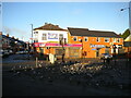
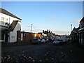
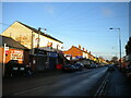
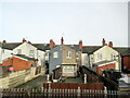
15 photos from this area
Area Information
Key information about the B8 3BP including its size, population, and administrative classification.
- Area Type
- Postcode
- Area Size
- 1.1 hectares
- Population
- 2759
- Population Density
- 11730 people/km²
House Prices in B8 3BP
57
Properties
£77,631
Average Sold Price
£16,200
Lowest Price
£200,500
Highest Price
Showing 57 properties
| Address | Type | Beds | Baths | Last Sale Price | Last Sale Date | |
|---|---|---|---|---|---|---|
| 17 Alderson Road, Birmingham, B8 3BP | Terraced | 3 | 1 | £200,500 | Mar 2023 | |
| 55 Alderson Road, Birmingham, B8 3BP | Terraced | 3 | 1 | £98,000 | Feb 2020 | |
| 84 Alderson Road, Birmingham, B8 3BP | house | - | - | £70,000 | Jun 2019 | |
| 41 Alderson Road, Birmingham, B8 3BP | Terraced | 3 | 1 | £140,000 | Jul 2018 | |
| 54 Alderson Road, Birmingham, B8 3BP | Terraced | 3 | - | £132,000 | Dec 2017 | |
| 51 Alderson Road, Birmingham, B8 3BP | Terraced | 3 | 1 | £102,000 | Jun 2017 | |
| 73 Alderson Road, Birmingham, B8 3BP | house | - | - | £80,000 | Mar 2017 | |
| 45 Alderson Road, Birmingham, B8 3BP | Terraced | 3 | - | £100,000 | Dec 2014 | |
| 52 Alderson Road, Birmingham, B8 3BP | house | - | - | £55,000 | Dec 2014 | |
| 46 Alderson Road, Birmingham, B8 3BP | house | - | - | £141,000 | Nov 2012 |
Page 1 of 6
Energy Efficiency in B8 3BP
Amenities
Schools
| Rank | School | Type | Entry gender | Ages |
|---|
Explore more schools in this area
Go to Schools tabDemographics
Household Size
Family (3-5 people)
most common
Accommodation Type
Houses
most common
Tenure
55
majority
Ethnic Group
asian_total
most common
Religion
N/A
most common
Household Composition
N/A
most common
Age
22
median
Adults (30-64 years)
most common
Household Deprivation
N/A
with no deprivation
NS-SEC
9
in Lower managerial occupations
Explore more demographic insights in this area
Go to Demographics tabPlanning
Planning Constraints
- Flood RiskPremium
- Ramsar Wetland SitesPremium
- Area of Outstanding Natural BeautyPremium
- Protected Nature ReservePremium
- Protected WoodlandPremium