Area Overview for B8 2TF
Photos of B8 2TF
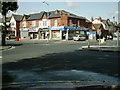
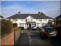
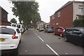
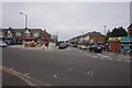
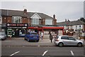
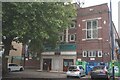
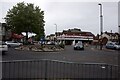
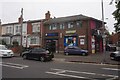
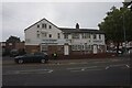
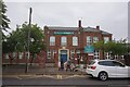
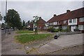
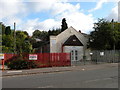
28 photos from this area
Area Information
Key information about the B8 2TF including its size, population, and administrative classification.
- Area Type
- Postcode
- Area Size
- 6748 m²
- Population
- 2196
- Population Density
- 10286 people/km²
House Prices in B8 2TF
17
Properties
£113,650
Average Sold Price
£29,000
Lowest Price
£210,000
Highest Price
Showing 17 properties
| Address | Type | Beds | Baths | Last Sale Price | Last Sale Date | |
|---|---|---|---|---|---|---|
| 803 Alum Rock Road, Birmingham, B8 2TF | Retail | 3 | 1 | £210,000 | Feb 2022 | |
| 799 Alum Rock Road, Birmingham, B8 2TF | house | - | - | £185,000 | May 2021 | |
| 793 Alum Rock Road, Birmingham, B8 2TF | house | - | - | £142,000 | Jul 2016 | |
| 801 Alum Rock Road, Birmingham, B8 2TF | Terraced | 3 | - | £138,000 | May 2016 | |
| 795 Alum Rock Road, Birmingham, B8 2TF | house | - | - | £145,000 | Jan 2016 | |
| 789 Alum Rock Road, Birmingham, B8 2TF | Terraced | 3 | - | £70,000 | Sep 2015 | |
| 785 Alum Rock Road, Birmingham, B8 2TF | house | - | - | £105,000 | Mar 2010 | |
| 805 Alum Rock Road, Birmingham, B8 2TF | house | - | - | £175,000 | Jul 2009 | |
| 781 Alum Rock Road, Birmingham, B8 2TF | house | - | - | £125,000 | Sep 2004 | |
| 787 Alum Rock Road, Birmingham, B8 2TF | Terraced | - | - | £71,500 | Dec 2001 |
Page 1 of 2
Energy Efficiency in B8 2TF
Amenities
Schools
| Rank | School | Type | Entry gender | Ages |
|---|
Explore more schools in this area
Go to Schools tabDemographics
Household Size
Family (3-5 people)
most common
Accommodation Type
Houses
most common
Tenure
59
majority
Ethnic Group
asian_total
most common
Religion
N/A
most common
Household Composition
N/A
most common
Age
22
median
Adults (30-64 years)
most common
Household Deprivation
N/A
with no deprivation
NS-SEC
13
in Lower managerial occupations
Explore more demographic insights in this area
Go to Demographics tabPlanning
Planning Constraints
- Flood RiskPremium
- Ramsar Wetland SitesPremium
- Area of Outstanding Natural BeautyPremium
- Protected Nature ReservePremium
- Protected WoodlandPremium