Area Overview for B8 2ET
Photos of B8 2ET
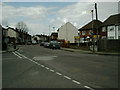

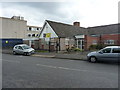
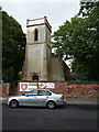
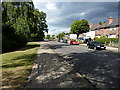
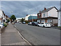
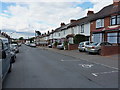

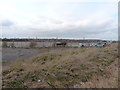
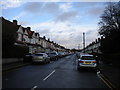
26 photos from this area
Area Information
Key information about the B8 2ET including its size, population, and administrative classification.
- Area Type
- Postcode
- Area Size
- 7351 m²
- Population
- 2115
- Population Density
- 3669 people/km²
House Prices in B8 2ET
11
Properties
£118,000
Average Sold Price
£72,500
Lowest Price
£150,000
Highest Price
Showing 11 properties
| Address | Type | Beds | Baths | Last Sale Price | Last Sale Date | |
|---|---|---|---|---|---|---|
| 470 Washwood Heath Road, Birmingham, B8 2ET | Terraced | 3 | 1 | £150,000 | Jun 2020 | |
| 466 Washwood Heath Road, Birmingham, B8 2ET | Terraced | 3 | 1 | £130,000 | Aug 2017 | |
| 468 Washwood Heath Road, Birmingham, B8 2ET | house | 3 | - | £105,000 | Sep 2016 | |
| 484 Washwood Heath Road, Birmingham, B8 2ET | house | 3 | 1 | £116,500 | Nov 2007 | |
| 464 Washwood Heath Road, Birmingham, B8 2ET | house | - | - | £145,000 | Jan 2007 | |
| 486 Washwood Heath Road, Birmingham, B8 2ET | Semi-detached | - | - | £107,000 | Dec 2004 | |
| 480 Washwood Heath Road, Birmingham, B8 2ET | house | - | - | £72,500 | Nov 2002 | |
| Tennis 86M From 484 Washwood Heath Road 28M From Unnamed Road, Washwood Heath Road, Birmingham, B8 2ET | Leisure | - | - | - | - | |
| 474 Washwood Heath Road, Birmingham, B8 2ET | house | - | - | - | - | |
| 472 Washwood Heath Road, Birmingham, B8 2ET | house | - | - | - | - |
Page 1 of 2
Energy Efficiency in B8 2ET
Amenities
Schools
| Rank | School | Type | Entry gender | Ages |
|---|
Explore more schools in this area
Go to Schools tabDemographics
Household Size
Family (3-5 people)
most common
Accommodation Type
Houses
most common
Tenure
39
majority
Ethnic Group
asian_total
most common
Religion
N/A
most common
Household Composition
N/A
most common
Age
22
median
Adults (30-64 years)
most common
Household Deprivation
N/A
with no deprivation
NS-SEC
11
in Lower managerial occupations
Explore more demographic insights in this area
Go to Demographics tabPlanning
Planning Constraints
- Flood RiskPremium
- Ramsar Wetland SitesPremium
- Area of Outstanding Natural BeautyPremium
- Protected Nature ReservePremium
- Protected WoodlandPremium