Area Overview for B8 1QX
Photos of B8 1QX
Area Information
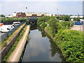
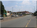
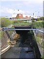
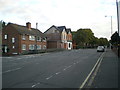
B8 1QX is a small, densely populated postcode area within Birmingham’s Alum Rock ward, covering 7,278 square metres and home to 1,745 residents. Its compact size and high population density of 239,754 people per square kilometre reflect its role as an inner-city residential cluster. Situated approximately 3.2 kilometres east of Birmingham’s city centre, the area is part of the broader Saltley district, a historically industrialised region with a mix of urban and community-focused features. Alum Rock Road, the area’s main thoroughfare, connects to surrounding suburbs like Stechford and Ward End, offering access to nearby amenities. Despite its proximity to the city, B8 1QX retains a distinct character shaped by its demographic profile and historical roots. The area’s name, derived from alum-rich rock used in leather tanning, hints at its industrial past, though modern life here is defined by a young, diverse population and a focus on local community hubs. For buyers, this postcode represents a compact, high-density living option with proximity to transport and retail, though challenges like flood risk must be weighed against its accessibility and amenities.
- Area Type
- Postcode
- Area Size
- 7278 m²
- Population
- 1745
- Population Density
- 11136 people/km²
The property market in B8 1QX is predominantly rental-focused, with only 45% of homes owned by residents. This suggests a high proportion of private rentals, which may influence affordability and availability for buyers. The area’s accommodation type is primarily houses, which is noteworthy given its high population density. This mix of house stock and rental prevalence indicates a niche market, where buyers might find limited options but potentially more spacious properties compared to high-rise or terraced housing. However, the small area size and proximity to Birmingham’s core mean that the housing stock is likely to be constrained, with little scope for expansion. For buyers, this could mean competition for a limited number of properties, particularly as the area’s younger population and rental demand may keep house prices stable or even drive them up. The predominance of houses also implies that properties may have larger gardens or more living space, which could appeal to those seeking family homes in a city setting.
House Prices in B8 1QX
No properties found in this postcode.
Energy Efficiency in B8 1QX
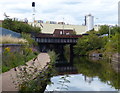
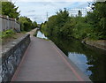
Living in B8 1QX offers access to a range of retail and transport amenities within practical reach. The area’s proximity to Costco Birmingham, Asda Armada, and Lidl Bordesley ensures convenient shopping options for groceries and household essentials. Nearby railway stations like Aston and Duddeston, along with metro stops at Bull Street and St Chads, provide efficient links to Birmingham’s transport network, enabling quick travel to work, education, or leisure. While the data does not list parks or recreational spaces explicitly, the area’s urban layout suggests that local green spaces may be limited, with community hubs like the Saltley Gate Peace Group offering social and cultural engagement. The presence of schools such as Washwood Heath Academy and Eden Boys’ Leadership Academy, referenced in local research, implies access to educational institutions, though these are not detailed in the provided data. Overall, daily life in B8 1QX balances urban convenience with the challenges of a high-density, inner-city environment.
Amenities
Schools
| Rank | School | Type | Entry gender | Ages |
|---|
Explore more schools in this area
Go to Schools tabDemographics
B8 1QX has a median age of 22, with the most common age group being adults aged 30–64. This suggests a community with a significant proportion of working-age residents, though the area’s 45% home ownership rate indicates that many residents are renters. The predominant accommodation type is houses, which is unusual for a high-density urban area. The population is ethnically diverse, with the Asian community making up the largest share, reflecting Birmingham’s broader demographic trends. However, the area is characterised by high deprivation, with low employment rates and above-average claimant count unemployment. This context means that quality of life can be strained by limited economic opportunities and potential reliance on public services. The 93.6% BAME population highlights the area’s cultural diversity but also underscores socioeconomic challenges, such as a higher proportion of working-age residents without qualifications. Daily life here is shaped by these demographics, with a focus on community cohesion and access to essential services despite the area’s economic constraints.
Household Size
Accommodation Type
Tenure
Ethnic Group
Religion
Household Composition
Age
Household Deprivation
NS-SEC
Explore more demographic insights in this area
Go to Demographics tabPlanning
Planning Constraints
- Flood RiskPremium
- Ramsar Wetland SitesPremium
- Area of Outstanding Natural BeautyPremium
- Protected Nature ReservePremium
- Protected WoodlandPremium