Area Overview for B8 1PR
Photos of B8 1PR
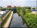
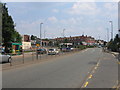
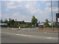
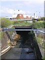
78 photos from this area
Area Information
Key information about the B8 1PR including its size, population, and administrative classification.
- Area Type
- Postcode
- Area Size
- 7668 m²
- Population
- 2068
- Population Density
- 6341 people/km²
House Prices in B8 1PR
37
Properties
£70,150
Average Sold Price
£19,000
Lowest Price
£162,500
Highest Price
Showing 37 properties
| Address | Type | Beds | Baths | Last Sale Price | Last Sale Date | |
|---|---|---|---|---|---|---|
| 26 Phillimore Road, Birmingham, B8 1PR | house | - | - | £162,500 | Feb 2025 | |
| 24 Phillimore Road, Birmingham, B8 1PR | house | - | - | £87,000 | Dec 2021 | |
| 23 Phillimore Road, Birmingham, B8 1PR | house | - | - | £100,000 | Oct 2020 | |
| 38 Phillimore Road, Birmingham, B8 1PR | Terraced | 3 | 1 | £105,100 | May 2019 | |
| 20 Phillimore Road, Birmingham, B8 1PR | house | - | - | £96,000 | Oct 2018 | |
| 6 Phillimore Road, Birmingham, B8 1PR | house | 2 | 1 | £69,500 | Mar 2014 | |
| 40 Phillimore Road, Birmingham, B8 1PR | house | 3 | 1 | £99,000 | Nov 2013 | |
| 28 Phillimore Road, Birmingham, B8 1PR | house | - | - | £78,000 | Jul 2012 | |
| 30 Phillimore Road, Birmingham, B8 1PR | house | 2 | 1 | £55,000 | Mar 2012 | |
| 29 Phillimore Road, Birmingham, B8 1PR | house | 2 | - | £70,000 | May 2010 |
Page 1 of 4
Energy Efficiency in B8 1PR
Amenities
Schools
| Rank | School | Type | Entry gender | Ages |
|---|
Explore more schools in this area
Go to Schools tabDemographics
Household Size
Family (3-5 people)
most common
Accommodation Type
Houses
most common
Tenure
44
majority
Ethnic Group
asian_total
most common
Religion
N/A
most common
Household Composition
N/A
most common
Age
22
median
Adults (30-64 years)
most common
Household Deprivation
N/A
with no deprivation
NS-SEC
10
in Lower managerial occupations
Explore more demographic insights in this area
Go to Demographics tabPlanning
Planning Constraints
- Flood RiskPremium
- Ramsar Wetland SitesPremium
- Area of Outstanding Natural BeautyPremium
- Protected Nature ReservePremium
- Protected WoodlandPremium