Area Overview for B8 1HP
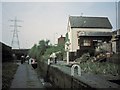
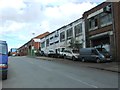
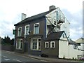
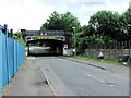
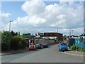
Photos of B8 1HP


Area Information
B8 1HP is a small residential postcode cluster nestled in Birmingham’s West Midlands, part of the broader Alum Rock area. With a population of 1,639, it sits approximately 2 miles east of Birmingham’s city centre, near the Saltley district. Historically linked to alum rock used in leather tanning, the area has evolved into a densely populated urban neighbourhood. Its character is defined by a young demographic, with a median age of 22, and a predominantly Asian community. Despite its compact size, the area offers proximity to key transport routes, including rail and metro links, and a mix of retail amenities. While it is described as diverse and historically deprived, recent data highlights a balanced approach to safety and connectivity. Living here means navigating a compact, inner-city environment with a focus on local services and community hubs, though challenges around deprivation and employment rates persist. The area’s proximity to Birmingham’s core makes it a practical choice for those seeking urban convenience without the city centre’s higher costs.
- Area Type
- Postcode
- Area Size
- Not available
- Population
- 1639
- Population Density
- 3508 people/km²
The property market in B8 1HP is defined by a 35% home ownership rate, suggesting that the majority of residents rent rather than own their homes. The accommodation type is primarily houses, which is atypical for an inner-city postcode, hinting at a mix of larger properties and family-oriented housing. This dynamic points to a rental market that may cater to both long-term tenants and those seeking affordable housing in Birmingham’s outskirts. Given the area’s small size and limited expansion potential, property availability is likely constrained, making it a niche market for buyers. The predominance of houses may appeal to families or individuals prioritising space, but the low home ownership rate indicates that investment opportunities here are limited compared to more affluent areas. For buyers, the compact nature of B8 1HP means competition for properties is likely to be high, with limited scope for development or price appreciation.
House Prices in B8 1HP
No properties found in this postcode.
Energy Efficiency in B8 1HP
Daily life in B8 1HP revolves around its compact urban layout and accessible amenities. Residents can shop at nearby supermarkets such as Lidl, Asda, and Iceland, which are within walking distance, making errands convenient. The area’s rail and metro stations, including Adderley Park and Bull Street, provide easy access to Birmingham’s employment hubs, universities, and cultural centres. While the data does not mention parks or leisure facilities, the proximity to Alum Rock Road—a 3 km shopping strip—suggests opportunities for casual dining and retail browsing. The presence of local schools and transport links fosters a community-oriented lifestyle, though the absence of detailed information on green spaces or recreational areas means residents may need to travel further for outdoor activities. The blend of retail, transport, and educational facilities creates a functional environment, albeit one that leans heavily on nearby districts for broader amenities.
Amenities
Schools
Residents of B8 1HP have access to a range of local schools, including Adderley Nursery School, which provides early education for young children, and Adderley Primary School, rated ‘good’ by Ofsted. These institutions cater to foundational education needs, with the primary school offering a reliable option for families. The presence of both nursery and primary schools within the area ensures that young children can attend local education without long commutes. However, the data does not include secondary schools, which may necessitate travel to nearby districts. For families prioritising proximity to schools, the combination of a nursery and a well-rated primary is a practical advantage. The absence of higher education facilities within the postcode, though, means that students may need to rely on nearby schools in Alum Rock or other parts of Birmingham for secondary education.
| Rank | School | Type | Entry gender | Ages |
|---|
Explore more schools in this area
Go to Schools tabDemographics
The community in B8 1HP is notably young, with a median age of 22 and the majority of residents aged 30–64. Home ownership stands at 35%, indicating a strong rental market with a significant portion of the population renting properties. The predominant accommodation type is houses, which is unusual for a high-density urban area, suggesting a mix of family homes and larger dwellings. The area’s ethnic composition is dominated by the Asian community, reflecting Birmingham’s broader diversity. However, the area is also characterised by high deprivation levels, which correlate with lower employment rates and higher claimant count unemployment. This context means residents may face challenges accessing high-quality services or opportunities, though the presence of schools and transport links offers some counterbalance. The combination of a young population, rental-focused housing, and ethnic diversity creates a distinct social fabric, though one shaped by economic constraints.
Household Size
Accommodation Type
Tenure
Ethnic Group
Religion
Household Composition
Age
Household Deprivation
NS-SEC
Explore more demographic insights in this area
Go to Demographics tabPlanning
Planning Constraints
- Flood RiskPremium
- Ramsar Wetland SitesPremium
- Area of Outstanding Natural BeautyPremium
- Protected Nature ReservePremium
- Protected WoodlandPremium