Area Overview for B8 1AH
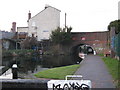
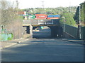
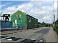
Photos of B8 1AH


Area Information
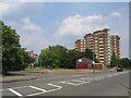
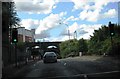
B8 1AH is a small residential postcode in central Birmingham, part of the Nechells district, which has a layered history of industrial development and post-war redevelopment. With a population of 2168, it reflects a compact, densely populated cluster typical of inner-city areas. The area’s character is shaped by its working-class roots, including former gasworks and railway infrastructure, alongside post-1950s high-rise flats now replaced by low-rise housing. Nechells, where B8 1AH lies, has long been a hub for immigration, particularly from the Caribbean and Indian sub-continent, creating a culturally diverse community. Daily life here is defined by proximity to retail, transport, and schools, with Co-op stores, railway stations, and primary schools within walking distance. The area’s compact size means residents are close to Birmingham’s city centre, yet it retains a distinct identity tied to its industrial past and ongoing urban renewal. For buyers, B8 1AH offers a blend of affordability, convenience, and historical context, though its small footprint means choices are limited to a few flats in a tightly knit neighbourhood.
- Area Type
- Postcode
- Area Size
- Not available
- Population
- 2168
- Population Density
- 2809 people/km²
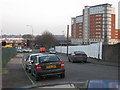
B8 1AH’s property market is dominated by flats, with home ownership at just 16%, suggesting a strong rental market. This low ownership rate implies limited opportunities for buyers seeking owner-occupied properties, though the area’s compact size means flats are concentrated in a small cluster. The predominance of flats may appeal to those prioritising affordability and proximity to amenities, but it also means the housing stock is largely uniform, with fewer detached or semi-detached homes. For buyers, this small postcode area offers limited options, though nearby parts of Nechells may provide more variety. The rental market is likely competitive, with demand driven by the area’s accessibility to transport and schools. However, the lack of data on property prices or recent developments means buyers should consider the area’s small footprint and potential for limited future growth.
House Prices in B8 1AH
No properties found in this postcode.
Energy Efficiency in B8 1AH
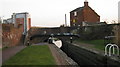
Living in B8 1AH offers a range of amenities within easy reach. Retail options include Co-op Birmingham and Tesco University, providing everyday shopping needs. The area’s proximity to railway stations and metro stops ensures swift access to Birmingham’s business and cultural hubs. Parks and leisure facilities are not explicitly detailed, but the nearby Nechells Baths, a Grade II listed building, suggests historical recreational spaces. The presence of Wing Yip Chinese food superstore and St Clements Nursing Home highlights a mix of commercial and community services. While specific parks or leisure venues are not named, the area’s compact size means residents can walk to most amenities. This convenience fosters a lifestyle where daily life is centred around local shops, transport, and community hubs, though the lack of detailed data on green spaces or leisure options means further research may be needed for a complete picture.
Amenities
Schools
Residents of B8 1AH have access to several primary schools, including St Matthew’s CofE Primary School and St Vincent’s Catholic Primary School, both rated ‘good’ by Ofsted. The Heartlands High School and Duddeston Manor Community School are also nearby, though their Ofsted ratings are not specified. St James College, an independent school, adds diversity to the educational landscape. The mix of state and independent schools provides families with options, from faith-based primary education to specialist independent institutions. However, the absence of secondary schools in the immediate area means students may need to commute to nearby high schools. The presence of multiple primary schools within walking distance is a practical advantage, though parents should verify secondary school catchment areas. This range of options reflects the area’s role as a residential hub for families seeking proximity to education.
| Rank | School | Type | Entry gender | Ages |
|---|
Explore more schools in this area
Go to Schools tabDemographics
The population of B8 1AH is 2168, with a median age of 22, though the most common age group is adults aged 30–64. This suggests a mix of younger residents and a working-age population, possibly linked to nearby employment opportunities. Home ownership is low at 16%, indicating a predominantly rental market, with flats being the primary accommodation type. The predominant ethnic group is Black, reflecting the area’s historical ties to post-war immigration. This demographic profile shapes the community’s dynamics, with a focus on shared living spaces and proximity to services. The low home ownership rate may impact long-term investment potential, though it also means a stable rental market. The area’s diversity, while not quantified beyond the Black population, aligns with Nechells’ broader history of multicultural settlement. For residents, this means a community with varied cultural influences, though specific data on deprivation or socio-economic challenges is not provided.
Household Size
Accommodation Type
Tenure
Ethnic Group
Religion
Household Composition
Age
Household Deprivation
NS-SEC
Explore more demographic insights in this area
Go to Demographics tabPlanning
Planning Constraints
- Flood RiskPremium
- Ramsar Wetland SitesPremium
- Area of Outstanding Natural BeautyPremium
- Protected Nature ReservePremium
- Protected WoodlandPremium