Area Overview for B8 1AB
Photos of B8 1AB
Area Information
Living in B8 1AB offers a distinct inner-city experience within the broader Saltley area of Birmingham. This specific postcode cluster covers just 7246 square metres, yet it accommodates 1639 residents. The resulting population density of 226189 people per square kilometre creates a very compact, high-density environment. The area functions as a residential hub centred heavily around Alum Rock Road, connecting to wider networks like Stechford and Ward End. The character of the location is defined by its urban setting and significant historical roots, having been first mentioned as Alum Rock in 1718. While the immediate postcode is a small residential cluster, it exists within the larger, diverse Alum Rock ward population of over 25,000 people. Residents here benefit from a location that places them approximately three and a half kilometres east of the city centre. The daily rhythm of life is shaped by a young demographic and close proximity to major thoroughfares. You will find a setting that prioritises accessibility over spaciousness, typical of an established inner-city suburb that has evolved significantly since the boundary changes of 2018. The area remains a practical base for those seeking a close-knit urban environment.
- Area Type
- Postcode
- Area Size
- 7246 m²
- Population
- 1639
- Population Density
- 3508 people/km²
The property market in B8 1AB is characterised by a significant rental presence alongside a minority of owner-occupied households. Specifically, home ownership rates sit at 35%, which means nearly two out of every three houses here are not owner-occupied. This statistic suggests that if you are planning to buy in B8 1AB, you are entering a competitive market where tenants may outnumber owners. The predominant accommodation type found in this small postcode is Houses, offering single-family living arrangements rather than high-density blocks. This housing stock provides a traditional British dwelling experience within an urban context. Given the high population density of 226189 people per square kilometre, buyers should consider how house sizes compare to anticipated space requirements. The area functions as a gateway to the wider Alum Rock ward, where the broader housing market also features a mix of properties serving a diverse population. Understanding that 35% of this specific cluster belongs to owners helps frame a realistic view of the local investment and resale landscape for prospective buyers seeking a foothold in this inner-city location.
House Prices in B8 1AB
No properties found in this postcode.
Energy Efficiency in B8 1AB
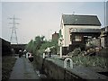
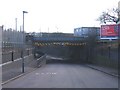
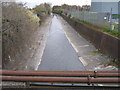
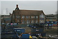
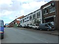
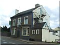
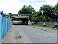
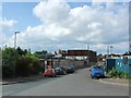
Your daily lifestyle in B8 1AB is shaped by immediate access to key amenities located within practical reach. For retail needs, there are five prominent shopping locations to choose from. You can shop at Co-op Birmingham, Lidl Bordesley, and Asda Bordersley for your weekly groceries and daily essentials. Transport links are similarly convenient, with five different rail stations and five major Metro stops nearby to assist with citywide travel. These transport hubs, including Adderley Park and Bull Street, ensure you can easily reach further employment or leisure centre locations. The area also contains notable historic features like the Brookhill Tavern, a Grade II listed pub that serves as a local social meeting point. The presence of Alum Rock Road, often referred to locally as The Rock, provides a designated shopping stretch within the wider context of the area. This combination of major supermarkets, reliable transit hubs, and specific local landmarks creates a functional environment where residents can manage their daily routines without extensive travel time to central hubs.
Amenities
Schools
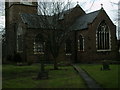
Families living in B8 1AB have access to specific educational institutions directly serving their local needs. The nearest provision includes Adderley Nursery School, catering to early years education for young children. For primary education, the area is served by Adderley Primary School, which holds an Ofsted rating of good. This rating indicates that the school meets expected standards for its governance and educational provision. The mix of a nursery and a primary school named Adderley suggests a cohesive educational route for younger families living in the immediate vicinity of the postcode. However, the data provided does not include secondary schools, meaning older children will likely commute further afield to complete their education. The presence of a rated good primary school is a significant asset for households with young children settling into the B8 1AB neighbourhood.
| Rank | School | Type | Entry gender | Ages |
|---|
Explore more schools in this area
Go to Schools tabDemographics
The community profile of B8 1AB is defined by a notably young population structure. The median age for residents stands at exactly 22 years, suggesting a neighbourhood heavily populated by younger adults and students. Data indicates that adults between the ages of 30 and 64 constitute the most common age range despite the low median figure. This demographic skew informs the local need for services and social spaces. Ethnically, the area is predominantly asian_total, contributing to a highly diverse population makeup. Ownership dynamics show that only 35% of residents own their homes, leaving the majority within the rental sector. The area primarily consists of Houses, distinguishing it from flats or other accommodation types found elsewhere in the city. This combination of high rental volume and single-home tenures suggests a market driven by landlords and younger families rather than long-term established homeowners. The high density further restricts outdoor private space for individuals in this cluster.
Household Size
Accommodation Type
Tenure
Ethnic Group
Religion
Household Composition
Age
Household Deprivation
NS-SEC
Explore more demographic insights in this area
Go to Demographics tabPlanning
Planning Constraints
- Flood RiskPremium
- Ramsar Wetland SitesPremium
- Area of Outstanding Natural BeautyPremium
- Protected Nature ReservePremium
- Protected WoodlandPremium