Area Overview for B79 9HL
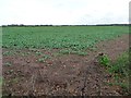
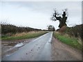
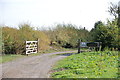
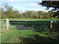
Photos of B79 9HL
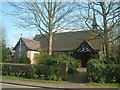
![Main Road, Haunton [1] in B79 9HL](https://images.propbar.co.uk/images/geograph/47/61/4761731_120.jpg)
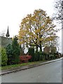
![Main Road, Haunton [2] in B79 9HL](https://images.propbar.co.uk/images/geograph/47/61/4761943_120.jpg)
20 photos from this area
Area Information
Key information about the B79 9HL including its size, population, and administrative classification.
- Area Type
- Postcode
- Area Size
- 31.6 hectares
- Population
- 2019
- Population Density
- 48 people/km²
House Prices in B79 9HL
21
Properties
£371,663
Average Sold Price
£235,000
Lowest Price
£590,800
Highest Price
Showing 21 properties
| Address | Type | Beds | Baths | Last Sale Price | Last Sale Date | |
|---|---|---|---|---|---|---|
| Syserscote Barn, Main Road, Haunton, Tamworth, B79 9HL | Bungalow | - | - | £300,000 | May 2023 | |
| Poachers Rest, Syerscote Lane, Haunton, Tamworth, B79 9HL | house | - | - | £570,000 | Sep 2021 | |
| St Marys Cottage, Main Road, Haunton, Tamworth, B79 9HL | Detached | 4 | 3 | £590,800 | May 2018 | |
| Summer Cottage, Main Road, Haunton, Tamworth, B79 9HL | Detached | 3 | - | £345,000 | Sep 2015 | |
| Grange Farm, Main Road, Haunton, Tamworth, B79 9HL | Semi-detached | - | - | £320,000 | Jul 2007 | |
| Old Cliffes Barn, Main Road, Haunton, Tamworth, B79 9HL | house | - | - | £265,000 | Jan 2007 | |
| Ferndale Barn, Main Road, Haunton, Tamworth, B79 9HL | Semi-detached | - | - | £347,500 | May 2006 | |
| Scrumpy Cottage, Main Road, Haunton, Tamworth, B79 9HL | Detached | - | - | £235,000 | May 2006 | |
| Chapel House, Main Road, Haunton, Tamworth, B79 9HL | Detached | 5 | 4 | - | - | |
| 1, St Johns Cottages, Main Road, Haunton, Tamworth, B79 9HL | Cottage | 3 | - | - | - |
Page 1 of 3
Energy Efficiency in B79 9HL
Amenities
Schools
| Rank | School | Type | Entry gender | Ages |
|---|
Explore more schools in this area
Go to Schools tabDemographics
Household Size
Two person
most common
Accommodation Type
Houses
most common
Tenure
74
majority
Ethnic Group
White
most common
Religion
N/A
most common
Household Composition
N/A
most common
Age
47
median
Adults (30-64 years)
most common
Household Deprivation
N/A
with no deprivation
NS-SEC
43
in Lower managerial occupations
Explore more demographic insights in this area
Go to Demographics tabPlanning
Planning Constraints
- Flood RiskPremium
- Ramsar Wetland SitesPremium
- Area of Outstanding Natural BeautyPremium
- Protected Nature ReservePremium
- Protected WoodlandPremium