Area Overview for B79 8WA
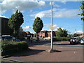
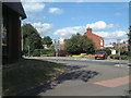
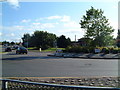
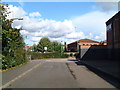
Photos of B79 8WA


Area Information
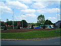
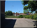
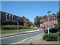
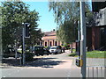
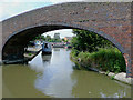
Living in B79 8WA, a small residential cluster in Staffordshire, offers a blend of historical charm and practical modernity. The area forms part of the Tamworth Conurbation, situated on the south bank of the River Anker. With a population of 1,618, it is a compact community where daily life is shaped by its proximity to Tamworth’s amenities and the surrounding countryside. The village of Bolehall, which includes this postcode, is steeped in history, with landmarks such as the Grade II listed Bolehall Viaduct and the historic Bole Hall manor dating to the 1700s. Residents benefit from nearby schools, retail outlets, and transport links, making it a self-contained yet connected place. The area’s modest size means a tight-knit community feel, with local traditions and natural spaces like Warwickshire Moor providing a contrast to urban life. For those seeking a balance between rural tranquillity and accessible services, B79 8WA offers a distinctive appeal.
- Area Type
- Postcode
- Area Size
- Not available
- Population
- 1618
- Population Density
- 4607 people/km²
The property market in B79 8WA is characterised by a high rate of home ownership (78%) and a predominance of houses as the primary accommodation type. This suggests a community where property is largely owner-occupied, with fewer rental properties available. The focus on houses rather than flats or apartments indicates a market catering to families or individuals seeking more space. Given the area’s small size, the housing stock is likely limited, meaning buyers should consider nearby areas for additional options. The high home ownership rate also implies stable property values and a lower likelihood of rapid price fluctuations. For those seeking a home in this area, the emphasis on houses means potential buyers may need to prioritise location within the cluster or explore adjacent postcode areas for broader choices.
House Prices in B79 8WA
No properties found in this postcode.
Energy Efficiency in B79 8WA
The lifestyle in B79 8WA is shaped by its proximity to a range of amenities, including retail outlets and transport hubs. Local shops such as Budgens Tamworth, Tamworth Co-operative Society, and Lidl Leyfields provide essential shopping needs, while the Victoria Road Bus Interchange connects residents to broader networks. The area’s small footprint means that daily errands and social activities are within walking or short driving distance. Nearby nature reserves like Warwickshire Moor offer opportunities for outdoor recreation, complementing the convenience of urban services. The mix of retail, transport, and green spaces creates a balanced lifestyle, blending practicality with access to natural environments. For residents, this means a community that supports both routine living and leisurely pursuits without requiring long commutes.
Amenities
Schools
Residents of B79 8WA have access to several educational institutions, including Tamworth Early Years Centre, which provides nursery education, and William MacGregor Primary School and Macgregor Junior School, both offering primary-level education. The presence of multiple primary schools within the area ensures that families have options for their children’s early education. However, no secondary schools are listed in the data, which may require residents to travel to nearby towns for further schooling. The concentration of primary schools supports families with young children, though the absence of secondary-level provision could be a consideration for those planning long-term residency. The proximity of these schools to homes in B79 8WA enhances the area’s appeal for families prioritising convenience.
| Rank | School | Type | Entry gender | Ages |
|---|---|---|---|---|
| 1 | Tamworth Early Years Centre | nursery | N/A | N/A |
| 2 | William MacGregor Primary School | primary | N/A | N/A |
| 3 | Macgregor Junior School | primary | N/A | N/A |
| 4 | William MacGregor Primary School | primary | N/A | N/A |
Explore more schools in this area
Go to Schools tabDemographics
The population of B79 8WA is predominantly adults aged 30–64, with a median age of 47, reflecting a mature, stable community. Home ownership is high at 78%, indicating a strong presence of long-term residents. The accommodation is primarily houses, suggesting a mix of family homes and single-occupancy properties. The predominant ethnic group is White, with no specific data on other demographics provided. This profile aligns with a community focused on settled living rather than transient populations. The absence of detailed diversity statistics means the area’s cultural makeup remains largely unexplored in the data, but the high home ownership rate and age distribution suggest a low turnover of residents. For buyers, this implies a predictable housing market with established neighbourhood dynamics.
Household Size
Accommodation Type
Tenure
Ethnic Group
Religion
Household Composition
Age
Household Deprivation
NS-SEC
Explore more demographic insights in this area
Go to Demographics tabPlanning
Planning Constraints
- Flood RiskPremium
- Ramsar Wetland SitesPremium
- Area of Outstanding Natural BeautyPremium
- Protected Nature ReservePremium
- Protected WoodlandPremium
- Crime RiskPremium