Area Overview for B79 8ES
Photos of B79 8ES
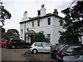
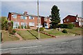
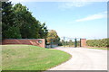
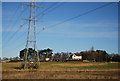
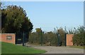
23 photos from this area
Area Information
Key information about the B79 8ES including its size, population, and administrative classification.
- Area Type
- Postcode
- Area Size
- 3468 m²
- Population
- 1676
- Population Density
- 4682 people/km²
House Prices in B79 8ES
7
Properties
£164,333
Average Sold Price
£61,000
Lowest Price
£295,000
Highest Price
Showing 7 properties
| Address | Type | Beds | Baths | Last Sale Price | Last Sale Date | |
|---|---|---|---|---|---|---|
| 110 Claremont Road, Tamworth, B79 8ES | house | 3 | - | £295,000 | Jul 2018 | |
| 104 Claremont Road, Tamworth, B79 8ES | Detached | 4 | 2 | £137,000 | Feb 2002 | |
| 100 Claremont Road, Tamworth, B79 8ES | Semi-detached | - | - | £61,000 | Sep 1997 | |
| 102 Claremont Road, Tamworth, B79 8ES | house | - | - | - | - | |
| 108 Claremont Road, Tamworth, B79 8ES | house | - | - | - | - | |
| 106 Claremont Road, Tamworth, B79 8ES | Detached | - | - | - | - | |
| Patterdale, 87 Claremont Road, Tamworth, B79 8ES | Detached | - | - | - | - |
Energy Efficiency in B79 8ES
Amenities
Schools
| Rank | School | Type | Entry gender | Ages |
|---|
Explore more schools in this area
Go to Schools tabDemographics
Household Size
Two person
most common
Accommodation Type
Houses
most common
Tenure
78
majority
Ethnic Group
White
most common
Religion
N/A
most common
Household Composition
N/A
most common
Age
47
median
Adults (30-64 years)
most common
Household Deprivation
N/A
with no deprivation
NS-SEC
28
in Lower managerial occupations
Explore more demographic insights in this area
Go to Demographics tabPlanning
Planning Constraints
- Flood RiskPremium
- Ramsar Wetland SitesPremium
- Area of Outstanding Natural BeautyPremium
- Protected Nature ReservePremium
- Protected WoodlandPremium