Area Overview for B79 7XN
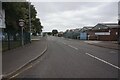
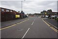
Photos of B79 7XN


Area Information
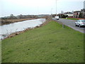
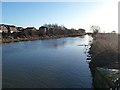
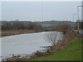
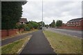
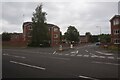
Living in B79 7XN means being part of a small, tightly knit residential cluster within the historic town of Tamworth, a place shaped by its Anglo-Saxon heritage and modern borough status. With a population of just 1,187, this area offers a quiet, low-density lifestyle, typical of a small community where daily life is defined by proximity to local amenities and historical landmarks. Situated in the Mercian Ward, it lies within the River Tame’s influence, a river that has shaped Tamworth’s identity since the 7th century. The area’s compact size means residents can easily access nearby services, while its location in Staffordshire’s West Midlands region connects it to broader regional networks. This postcode is ideal for those seeking a stable, family-oriented environment with minimal urban sprawl. The presence of multiple railway stations and a bus interchange within practical reach ensures connectivity without the congestion of larger towns. For buyers, B79 7XN represents a blend of historical significance and modern convenience, where the past and present coexist in a compact, manageable footprint.
- Area Type
- Postcode
- Area Size
- Not available
- Population
- 1187
- Population Density
- 1395 people/km²
The property market in B79 7XN is characterised by high home ownership (87%) and a focus on houses rather than flats or apartments. This suggests a community where property is primarily owner-occupied, with limited rental activity. The prevalence of houses indicates a market geared toward families or individuals seeking larger, private living spaces. Given the area’s small size and low population density, the housing stock is likely limited but well-established, with properties that have remained in the same hands for generations. Buyers should consider that the market is not driven by speculative investment but by long-term residency. The compact nature of the area means that properties are likely to be in close proximity to local amenities, enhancing their appeal. For those seeking a home in B79 7XN, the emphasis on owner-occupation and single-family homes points to a market that prioritises stability and permanence over short-term gains.
House Prices in B79 7XN
No properties found in this postcode.
Energy Efficiency in B79 7XN
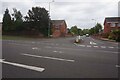
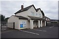
Residents of B79 7XN have access to a range of nearby amenities that support daily life. The area includes five retail outlets, such as Co-op Leyfields and Spar, providing essential shopping options within walking distance. A bus interchange at Victoria Road serves as a hub for local transport, while five railway stations—Tamworth High Level, Wilnecote, and Polesworth—offer connections to broader networks. These stations facilitate easy travel to Tamworth’s town centre, where additional services and cultural attractions are available. The presence of multiple retail and transport options ensures convenience without the need for long journeys. While the area’s small size limits large-scale leisure facilities, its proximity to Tamworth’s historic core and surrounding towns means residents can access more extensive amenities nearby. This blend of local convenience and regional accessibility creates a lifestyle that balances simplicity with opportunity.
Amenities
Schools
| Rank | School | Type | Entry gender | Ages |
|---|
Explore more schools in this area
Go to Schools tabDemographics
The community in B79 7XN is predominantly composed of adults aged 30–64, with a median age of 47, reflecting a mature, established population. Home ownership is exceptionally high at 87%, indicating a stable, long-term resident base rather than a transient rental market. The accommodation type is primarily houses, suggesting a focus on family homes and single-family living. The predominant ethnic group is White, aligning with broader trends in the region. This demographic profile implies a community with strong local ties and a low turnover rate. The age range suggests a mix of professionals, families, and retirees, all contributing to a balanced social fabric. With no specific deprivation data provided, the area’s high home ownership and age demographics hint at a relatively affluent, settled population. This stability may influence local services and amenities, ensuring they cater to long-term residents rather than temporary occupants.
Household Size
Accommodation Type
Tenure
Ethnic Group
Religion
Household Composition
Age
Household Deprivation
NS-SEC
Explore more demographic insights in this area
Go to Demographics tabPlanning
Planning Constraints
- Flood RiskPremium
- Ramsar Wetland SitesPremium
- Area of Outstanding Natural BeautyPremium
- Protected Nature ReservePremium
- Protected WoodlandPremium