Area Overview for B79 7WB
Photos of B79 7WB


Area Information
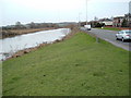
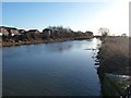
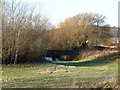
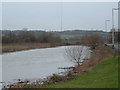
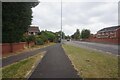
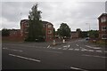
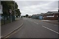
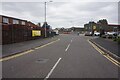
Living in B79 7WB means being part of a small, tightly knit residential cluster within the historic town of Tamworth, a place steeped in Anglo-Saxon heritage. The area falls within the Mercian Ward, an electoral division that reflects the town’s role as the former capital of the Kingdom of Mercia. With a population of 1362, it is a compact community where the rivers Tame and Anker define the landscape. Daily life here balances historical significance with modern convenience, offering proximity to Tamworth’s central amenities while retaining a quiet, residential character. The area is well-served by transport links, including nearby railway stations and a bus interchange, ensuring easy access to surrounding towns. Its small size means a strong sense of community, with local shops and services within walking distance. For those drawn to heritage and practicality, B79 7WB combines the charm of a historic town with the reliability of contemporary infrastructure.
- Area Type
- Postcode
- Area Size
- Not available
- Population
- 1362
- Population Density
- 2722 people/km²
The property market in B79 7WB is characterised by high home ownership, with 93% of properties occupied by their owners. This indicates a strong preference for private residence, suggesting the area is not a rental hotspot but rather a place where people invest in long-term living. The accommodation type is predominantly houses, which may appeal to those seeking larger living spaces or families. Given the small size of the postcode area, the housing stock is likely limited, making it a niche market for buyers prioritising proximity to Tamworth’s amenities. The high ownership rate also implies a stable market with little turnover, which could be advantageous for buyers seeking security in their investment. However, the limited number of properties means competition may be keen for those interested in purchasing within this specific cluster.
House Prices in B79 7WB
No properties found in this postcode.
Energy Efficiency in B79 7WB
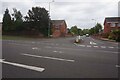
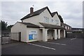
The lifestyle in B79 7WB is shaped by its proximity to essential amenities. Local shops include Co-op Leyfields, Spar, and the Tamworth Co-operative Society, offering everyday essentials within walking distance. The Victoria Road Bus Interchange provides access to regional routes, while nearby railway stations like Tamworth High Level and Wilnecote connect residents to broader networks. Though the area is small, it benefits from Tamworth’s broader offerings, including cultural and leisure facilities. The retail options, combined with transport links, create a convenient daily life, where residents can meet practical needs without long commutes. While the area lacks large-scale leisure venues, its compact size ensures a focus on simplicity and accessibility, appealing to those who value efficiency in their routines.
Amenities
Schools
| Rank | School | Type | Entry gender | Ages |
|---|
Explore more schools in this area
Go to Schools tabDemographics
The community in B79 7WB is predominantly composed of adults aged 30–64, with a median age of 47. This suggests a mature, stable population, likely with established careers and long-term ties to the area. Home ownership is exceptionally high at 93%, indicating a strong preference for private residence over rental properties. The accommodation type is primarily houses, which aligns with the area’s residential character and may appeal to families or individuals seeking space. The predominant ethnic group is White, reflecting the broader demographic trends in Tamworth. While no specific deprivation data is provided, the high home ownership rate and low crime risk suggest a quality of life that is secure and community-focused. This profile paints a picture of a place where residents are likely to have long-term plans, with a focus on stability and local connection.
Household Size
Accommodation Type
Tenure
Ethnic Group
Religion
Household Composition
Age
Household Deprivation
NS-SEC
Explore more demographic insights in this area
Go to Demographics tabPlanning
Planning Constraints
- Flood RiskPremium
- Ramsar Wetland SitesPremium
- Area of Outstanding Natural BeautyPremium
- Protected Nature ReservePremium
- Protected WoodlandPremium